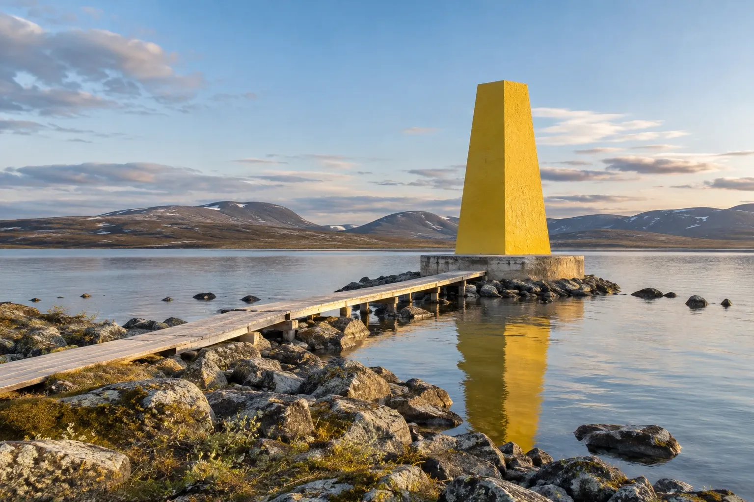
Nordkalottleden isn’t one trail with one owner. It’s three national trail networks stitched together, with three hut systems, three currencies, two time zones and a customs border you cross on foot. This guide covers what changes each time you step over a border.
When you need this
You’re weighing Nordkalottleden against Kungsleden or Padjelantaleden for a long Arctic hike. Or you’re planning a section that dips into Norway or Finland and want to know what changes at the border. Or you need to know whether the dog can come, which huts need a key, and what money to carry.
One trail, three countries
Nordkalottleden is the Swedish name. Norwegians call it Nordkalottruta, Finns Kalottireitti, and English pages “the Arctic Trail” or “Nordkalott Trail”. Metsähallitus, Finland’s state land manager, says the trail was set up in 1993 and is more than 800 km long. Länsstyrelsen Norrbotten, the Swedish county board, says it was built by linking existing trails in the three countries.
| Fact | Figure |
|---|---|
| Length | More than 800 km (Metsähallitus); about 800 km (county board) |
| Split by country | Norway ~380 km · Sweden ~350 km · Finland ~75 km |
| Northern end | Kautokeino, Norway |
| Southern end | Kvikkjokk, Sweden, or Sulitjelma, Norway |
| Overnight places | More than 40, usually 10–20 km apart, some stages ~30 km |
| Border crossings | Ten on the whole trail, by the county board’s count |
The headline fact most write-ups skip: almost half the trail is in Norway. That decides how you sleep, how you pay and whether your dog can come. In Sweden the trail shares long stretches with Kungsleden and Padjelantaleden. In Finland it crosses Malla Strict Nature Reserve, the Saana and Kilpisjärvi area and Käsivarsi Wilderness Reserve.
Don’t plan by the total. Sources disagree on the length and on the Finnish share; plan stage by stage.
Three hut systems
Each country runs its own huts, and they work nothing alike.
| Country | Who runs the huts | Key? | Booking | Payment |
|---|---|---|---|---|
| Finland | Metsähallitus | Open huts unlocked | Open huts: none. Shared rental huts: eraluvat.fi | Open huts free; rental huts per bed |
| Norway | DNT (the Norwegian Trekking Association) | Most self-service huts locked with the standard DNT key | Optional; no one is turned away | In NOK, drop-in often via the DNT app |
| Sweden | Mostly STF; in Padjelanta the park’s own operator | No | STF huts through STF; Padjelanta park huts can’t be booked | STF huts per STF price list; Padjelanta kiosks cash only |
The DNT key is the one that catches people out. DNT lends it only to members, against a small deposit, and at least one person in your group must be a member. Get it from DNT offices, staffed DNT cabins or DNT’s online store. An older trail description on DNT’s platform says STF members can borrow it too, but DNT’s own FAQ says members only. If you’re counting on an STF card, ask DNT first.
Finland’s open wilderness huts (autiotupa) are free and unlocked. Stay a night or two, and if you got there first, make room for latecomers. They can be full. Swedish huts are mostly STF’s and staffed in summer; see STF mountain huts for booking. Padjelanta’s park huts have their own rules, covered in our Padjelantaleden guide.
Whatever the hut system, carry a tent. Metsähallitus calls it essential for safety. The rules for pitching it differ by country:
- Norway: at least 150 m from an inhabited house or cabin, up to two nights in one place, longer in remote mountains.
- Sweden: a night or two under allemansrätten (the right of public access); see wild camping in Sweden. Abisko National Park allows tents only at designated places.
- Finland, Malla Strict Nature Reserve: only by the Kuohkimajärvi huts.
Crossing borders on foot
All three countries are in Schengen, so the trail has no passport checks. But that isn’t the whole story.
Carry a passport or national ID card. Polisen recommends one even inside the Nordic countries. Sweden had also notified border controls on all its internal borders until 11 November 2026.
Norway is outside the EU customs union. A cairn on a fell is still a customs border, and the quota applies on foot:
| Into Norway, per person | Limit |
|---|---|
| Spirits / wine / beer | 1 L / 1.5 L / 2 L |
| Tobacco (tourists) | 200 cigarettes or 250 g |
| Meat, meat products and cheese | 10 kg |
Over the quota? Declare it in Norway’s customs app before you cross. It works for unmanned crossings too. Coming back into Sweden from Norway, Sweden’s non-EU limits apply: 1 L spirits, 4 L wine, 16 L beer. Full rules are in crossing the Sweden–Norway border.
Money: kronor in Sweden, Norwegian kroner in Norway, euros in Finland. Bring cash for Padjelanta’s kiosks.
Time: Kilpisjärvi runs on Finnish time, one hour ahead of Sweden and Norway. Set your watch when you reach the village, or you’ll be an hour off for anything timed there.
Dogs: possible in sections, not on the whole trail
This is the rule trail write-ups miss. Every time a dog enters Norway from Sweden, a vet must have treated it for fox dwarf tapeworm 24 to 120 hours earlier, and recorded it in the pet passport. You can’t do the treatment yourself. Dogs entering Norway from Finland are exempt. Regular crossers can switch to a 28-day treatment regime instead.
The trail goes from Sweden into Norway more than once, and there are no vets on the fells. Add the park rules:
- Padjelanta National Park: dogs only 1 January–30 April, leashed. In summer they’re banned.
- Abisko National Park: leashed, on marked trails.
- Malla Strict Nature Reserve: always leashed.
- Huts: not all Finnish huts accept dogs, and at STF Pältsa dogs stay in the old cabin.
A section hike in Finland and northern Sweden with a leashed dog works. The whole trail realistically doesn’t. For pet-passport basics, see bringing a dog to Sweden.
The route section by section
| Section (north to south) | Countries | Notes |
|---|---|---|
| Kautokeino – Kopmajoki | Norway → Finland | Roughly 200 km; cairns with red T’s |
| Kopmajoki – Kilpisjärvi | Finland | Käsivarsi; free open huts; Halti side trip from Pitsusjärvi |
| Kilpisjärvi – Treriksröset | Finland → Sweden | 20 km through Malla; memorial stone at the cairn |
| Treriksröset – Pältsa | Sweden | 13 km, 4–6 hours, up to about 800 m |
| Pältsa – Abisko | Norway → Sweden | Long Norwegian stretch on DNT huts |
| Abisko – Alesjaure | Sweden | Shared with Kungsleden; Abisko National Park rules |
| Into Norway and back to Vaisaluokta | Norway → Sweden | Route descriptions differ here; seasonal bridges |
| Vaisaluokta – Padjelanta – Staddajåkk | Sweden | Shared with Padjelantaleden |
| Staddajåkk – Sulitjelma, or via Vaimok to Kvikkjokk | Norway or Sweden | The two southern endings |
Treriksröset, the Three-Country Cairn, is the trail’s landmark. It is Sweden’s northernmost point and the westernmost point of mainland Finland. From Kilpisjärvi you can walk the 20 km, or take a private summer boat across the lake to Koltaluokta and walk about 3 km. Kilpisjärvi itself is on a road and a bus line, about 290 km north of Kiruna.
Malla Strict Nature Reserve has the trail’s strictest rules. From 16 May to 31 October, stay on the marked trail. Fires, fishing and picking berries or mushrooms are all banned.
STF Pältsa, 13 km south of the cairn, is the first Swedish hut. It has 26 beds and a sauna and is staffed 2 July–12 September in 2027. Markings change at each border: half-metre posts in Finland, cairns and cross-poles in Sweden, cairns with red T’s in Norway. Some stretches are sparsely marked, so you need a map, a compass and the skill to use them.
When to go
July to early September. Metsähallitus says June often still has snow on the fells, and August and early September are the busiest weeks. Swedish seasonal bridges are normally out by 1 July and come in at the end of September. Three of them are on this trail: Vaisaluokta–Norwegian border, Vaisaluokta–Kutjaure and Hukejaure–Sitasjaure. Outside that window you wade or turn back.
Many rivers have no bridge at all. Don’t wade fast water above the knee. In early-summer flood, even the Kitsiputous waterfall crossing in Malla can be hard. The midnight sun lasts until July, daylight shrinks fast in August and September, and lasting snow can settle in late September. Nordkalottleden is not a winter route. Snow can fall in any month, so pack for all four seasons.
Phones and emergencies
Long stretches have no signal. STF says Pältsa has none, though you can reach a Finnish mast from a hill 3 km south. Where there is a network, EU roaming rules cover Norway as well as Sweden and Finland. Most Swedish huts and shelters in roadless country have a help phone.
| Country | Emergency number |
|---|---|
| Sweden | 112 (the police lead mountain rescue) |
| Finland | 112 |
| Norway | 112 police · 113 ambulance · 110 fire |
Sign each hut’s guest book with your route, and leave a travel plan with someone at home. More in mountain safety in Sweden and mobile coverage in the wilderness.
Practical information
| Item | Detail (checked 2026-10-15) |
|---|---|
| Walking the trail | Free; no permit for individual hikers |
| Finnish open wilderness hut | Free, a night or two |
| Finnish shared rental hut | Per bed, booked at eraluvat.fi |
| DNT self-service/no-service cabin | NOK 250–350 per night (DNT’s typical range) |
| DNT key | Members only, small deposit; one member per group |
| STF huts in Sweden | STF price list (STF mountain huts) |
| Padjelanta park huts | See Padjelantaleden |
| Kilpisjärvi–Koltaluokta boat | Private operator, summer only; fare set by the operator |
| STF Pältsa season | 2 July–12 September 2027 |
| Seasonal bridges, Sweden | Normally out by 1 July, in at end of September |
| Currencies | SEK · NOK · EUR |
| Time zone | Finland one hour ahead of Sweden and Norway |
FAQ
How long is Nordkalottleden and where does it start and end?
About 800 km. Metsähallitus gives more than 800 km, split into roughly 380 km in Norway, 350 km in Sweden and 75 km in Finland. The northern end is Kautokeino in Norway. In the south you choose between Kvikkjokk in Sweden and Sulitjelma in Norway. Most hikers walk sections rather than the whole trail in one summer.
Do I need a passport to hike Nordkalottleden?
Carry one, or a national ID card if you are an EU or EEA citizen. All three countries are in Schengen, so there are normally no passport checks on the trail, but Polisen recommends carrying ID even inside the Nordic countries, and Sweden had notified border controls on all its internal borders until 11 November 2026.
Can I bring alcohol or food across the border on foot?
Only within Norway’s quota: 1 litre of spirits, 1.5 litres of wine and 2 litres of beer, and no more than 10 kg of meat and cheese. The border on a mountain trail is still a customs border. Anything over the quota must be declared before crossing, which Norway’s customs app allows even at an unmanned crossing.
Are the huts on Nordkalottleden open to everyone?
Yes, but they work differently in each country. Finland’s open wilderness huts are free and unlocked. Most Norwegian huts are self-service and locked with the standard DNT key, which only DNT members can borrow; one member per group is enough. Swedish huts are mostly STF’s and staffed in summer. Carry a tent anyway.
Can I hike Nordkalottleden with a dog?
Only in parts. Every time a dog enters Norway from Sweden it needs tapeworm treatment from a vet 24 to 120 hours before, recorded in its pet passport. Padjelanta National Park bans dogs from May to December. Malla and Abisko require a leash. Section hikes in Finland and northern Sweden are possible; the whole trail realistically is not.
When is the best time to hike Nordkalottleden?
July to early September. Snow often lingers into June, and Swedish seasonal bridges are normally in place by 1 July and removed at the end of September. August and early September are the busiest weeks. The STF hut at Pältsa is staffed from 2 July to 12 September in 2027. Lasting snow can arrive in late September.
Will my phone work on Nordkalottleden?
Only in places. Long stretches have no signal; STF says Pältsa has none except from a hill 3 km south. Where there is a network, EU roaming rules cover Norway as well as Sweden and Finland. Emergency numbers differ: 112 in Sweden and Finland, and in Norway 112 for police and 113 for an ambulance.
Related guides
- Padjelantaleden — the shared southern stretch, its unbookable huts and cash-only kiosks.
- Kungsleden — the shared stretch from Abisko, with STF huts all the way.
- Crossing the Sweden–Norway border — the full customs rules both ways.
- Abisko National Park — the park rules on the Swedish middle section.
- Mountain safety in Sweden — fords, help phones and travel plans.
Facts verified 2026-10-15. Sources: Metsähallitus, Länsstyrelsen Norrbotten, Naturvårdsverket, Mattilsynet, Tolletaten, Tullverket, Polisen, the European Commission, DNT and STF — full register in this topic’s source file. Found something outdated? Tell us and we’ll fix it.