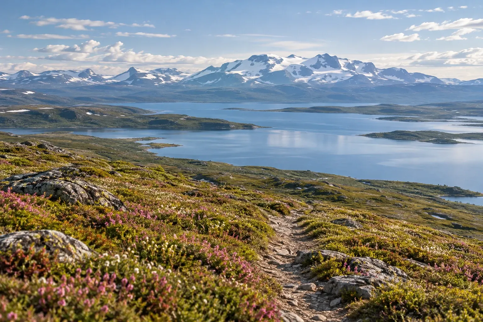
Padjelantaleden is the gentle way into Sweden’s most remote mountains, but it runs on different rules from Kungsleden. Two hut operators, one of which takes no bookings, boats at both ends and a strict summer dog ban decide how you plan it.
When you need this
You’re choosing a first long mountain trip and weighing Padjelantaleden against Kungsleden or Sarek. Or you’ve picked it and need to know which huts you can book, how much cash to carry, and how the boats at Ritsem and Kvikkjokk work. Our Sarek guide covers the trackless park to the east; this page covers the marked trail beside it and the hut system that runs it.
The trail at a glance
Padjelantaleden (Badjelánndaleden in Lule Sámi) runs between Ritsem in the north and Kvikkjokk in the south. Most of it crosses Padjelanta/Badjelánnda National Park, which Naturvårdsverket, the Swedish Environmental Protection Agency, calls Sweden’s largest national park by area. The park was created in 1962 for its unusually rich mountain flora and has been part of the Laponia World Heritage area since 1996. Naturvårdsverket calls it the place in Sweden farthest from a public road.
The land is open, rolling and mostly above the tree line, much softer than Sarek’s high peaks. Both the park manager and Naturvårdsverket call the trail easy to walk. The southern end through the Tarradalen valley runs through birch forest.
How long is it? STF, the Swedish Tourist Association, and Naturvårdsverket both say about 160 km. STF’s own ten stages add up to about 140 km, including a 3 km boat ride, and the park hut operator’s distance tables also give about 141 km from the Änonjálmme boat landing to Kvikkjokk. Plan nine to ten walking days either way.
Stage by stage
STF describes the trail north to south in ten stages. You can walk it in either direction.
| Stage | Distance | Hours | Overnight (operator) |
|---|---|---|---|
| Änonjálmme landing – Akka – Gisuris | 2 + 14 km | 3–5 | Akka (STF), Gisuris (park operator) |
| Gisuris – Låddejåhkå | 23 km | 7–9 | Låddejåhkå (park operator) |
| Låddejåhkå – Árasluokta | 13 km | 3–4 | Árasluokta (park operator) |
| Árasluokta – Stáloluokta | 10 km | 3–4 | Stáloluokta (park operator) |
| Stáloluokta – Duottar | 18 km | 5–7 | Duottar (park operator) |
| Duottar – Darreluoppal | 11 km | 3–4 | Darreluoppal (park operator) |
| Darreluoppal – Såmmarlappa | 15 km | 4–6 | Såmmarlappa (STF) |
| Såmmarlappa – Tarrekaise | 13 km | 4–6 | Tarrekaise (STF) |
| Tarrekaise – Njunjes | 6 km | 2–4 | Njunjes (STF) |
| Njunjes – Kvikkjokk | 12 km + 3 km boat | 4–6 | Kvikkjokk Fjällstation (STF) |
Gisuris is where three national parks meet: Sarek, Stora Sjöfallet and Padjelanta. The second stage is the longest. To shorten it, get off the boat at Vájsáluokta instead and walk 18 km to STF Kutjaure; from there it’s 19 km to Låddejåhkå.
Many hikers call Árasluokta–Stáloluokta the finest stage: 10 km over flowering heath with the Sulitelma massif on the horizon. The Nordkalottleden shares the trail in places and continues south there, while Padjelantaleden turns south-east. The trail’s highest point, 960 m, lies between Duottar and Darreluoppal, and STF says snow often lingers there well into summer.
Want only half? Regular helicopter flights run from both Kvikkjokk and Ritsem to Stáloluokta in the middle of the park, so you can fly one way and walk the other.
Two hut systems: what you can book and how you pay
This is the part most planners get wrong. STF runs the huts at the far north and south ends: Akka, Kutjaure, Såmmarlappa, Tarrekaise and Njunjes, plus STF Kvikkjokk Fjällstation at the southern end. You book those through STF, as described in our STF mountain huts guide.
The hut camps inside the national park are run by Badjelánnda Laponia Turism, a hut operator that is independent of STF. That changes three things:
- No bookings. Everyone who arrives gets somewhere to sleep. Paying in advance is not a reservation.
- No STF discount. Membership does not lower the price.
- Cash for food. Since 2024 you can pay for your bed by card at every camp in summer, and invoices ended in 2026. But food from the hut hosts’ kiosks is cash only.
You can prepay by bank transfer and carry a printed receipt, which the operator prefers, or buy a lodging ticket at the Jokkmokk tourist office or STF Kvikkjokk Fjällstation. Bring small notes of 20, 50 and 100 kronor, because change is scarce in the mountains, and card terminals don’t always work. If you’re new to carrying cash in Sweden, see cash in Sweden.
The kiosks sell a basic range: tinned food, crispbread, pasta, and sometimes gáhkku (Sámi soft bread), fish or meat. The operator warns that stock can run out, especially late in the season, so carry food for the whole trip. Every camp also sells maps and fishing licences in summer. STF lists shops at Ritsem, Såmmarlappa and Kvikkjokk.
What the park huts provide:
- Self-catering cabins with gas for heating and cooking, cutlery and crockery, blankets and pillows
- No electricity: bring a power bank, because hosts can’t charge it
- Dry toilets at the camps
- At least one cabin open all year at every camp, with an emergency phone
You must bring your own sheet or travel sheet. Groups of more than six can phone the operator for the code to a locked cabin, paid in advance.
Getting there: boats at both ends
There is no road anywhere along the trail. Both ends need a boat, and a missed boat or bus costs a day.
North. Take the train to Gällivare and the seasonal Road to Ritsem bus, which sells all its tickets as part of a train ticket; choose Ritsem Fjällstation as your final stop. From Ritsem, the M/S Storlule boat crosses Áhkkájávrre (Akkajaure) to Änonjálmme and Vájsáluokta. STF Akka is 2 km from the Änonjálmme landing.
Out of date elsewhere: many guides still describe an “STF ferry” from Ritsem. STF no longer runs it; M/S Storlule is privately operated, and STF’s own hut page says so.
South. Take the train to Murjek and the direct summer bus to Kvikkjokk, or a bus via Jokkmokk, which lies about 120 km by road from Kvikkjokk. From Kvikkjokk a mandatory boat crosses the river to the trailhead; two local operators run it. From the landing it’s about 12 km to Njunjes. Our guide to the fjäll by public transport has the bus details.
The boats can be cancelled in rough weather. Allow a spare day at each end.
Walking through Sámi land
Badjelánnda means “the upper land”. Three samebyar (Sámi reindeer-herding communities) — Sirges, Jåhkågasska tjiellde and Duorbbun, also spelled Tuorpon — use the park as summer grazing land. Their summer settlements, visten, line the big lakes Virihávrre, Vásstenjávrre and Sáluhávrre, and the trail passes several of them. Many hikers stop to buy smoked fish and fresh bread.
Árasluokta and Stáloluokta have a kyrkkåta, a Sámi tent-shaped chapel, and boat rides across Virihávrre can be arranged there. Stáloluokta is the biggest camp, with 42 beds and a sauna; the operator describes it as Tuorpon sameby’s summer land. These are people’s homes and workplaces, not open-air museums. For background, read our guide to Sámi culture.
Reindeer are the reason the settlements exist. Under the Reindeer Husbandry Act you may not scare, disturb or drive away reindeer, and the park regulations add a ban on disturbing grazing reindeer or a herd being gathered. Keep your distance: if the herd moves away, you’re too close. During calf marking, wait if a herd is being gathered, and don’t pitch your tent at the bottom of a narrow valley. More in our guide to reindeer in Sweden.
Park rules: dogs, fishing, drones, fires
| Activity | Rule in Padjelanta | Type |
|---|---|---|
| Dogs | Only 1 January–30 April, leashed; banned the rest of the year | Law |
| Fishing | Only in specially designated waters, with a licence and county board rules | Law |
| Hunting, motorboats, motor vehicles | Banned | Law |
| Berries and edible mushrooms | Allowed | Law |
| Cycling, riding | Banned | Law |
| Drones | No flying below 2,000 feet without a permit | Guidance |
| Fires | Allowed with loose sticks from the ground; no breaking or cutting | Guidance |
| Tent | A couple of days at the same spot under allemansrätten | Guidance |
The dog rule catches people out. Sarek and Stora Sjöfallet have an all-year leashed corridor on Kungsleden, but the regulation gives Padjelanta none. Since most of the trail lies inside the park, a summer hike means leaving the dog at home. The leash law guide has the other mountain parks. Sámi reindeer herders may use dogs, vehicles and aircraft as part of herding; that right does not extend to visitors.
When to go
| Period | What to expect |
|---|---|
| Late April–May | Reindeer calving; thaw makes the land hard to cross from mid-May |
| Late June | Most snow gone, spring flood running hard; bridges in from 25 June; park huts open around 28 June |
| July | High season, mosquitoes, calf marking |
| August | Often fine, fewer mosquitoes, clear air |
| Early September | Park hut camps close around 6 September; the Ritsem boat stops |
| Week 39 | Seasonal bridges removed |
| October–April | First snow; one cabin per camp open, no kiosk sales or card payment |
Laponiatjuottjudus, the Laponia park manager, calls mid-July to September the best window in western Laponia. After a late spring, the ground stays wet and streams run strong with meltwater. In summer 2026 the Road to Ritsem bus ran from 22 June to 20 September, and the direct bus to Kvikkjokk from 15 June to 16 August; outside summer, the Kvikkjokk bus runs on weekdays only.
Safety: no signal, fords and the long middle
Mobile coverage ends with the roads. The hut operator lists reception only at Ritsem, Änonjálmme, Vájsáluokta and Kvikkjokk. Every hut camp has a help phone, connected to the police, in the cabin kept open all year. Leave a travel plan with someone before you lose signal, and phone ahead for any boat you need. See our mountain safety guide and the note on mobile coverage.
The seasonal bridges are in place from 25 June until week 39; in 2026 Laponiatjuottjudus reported them removed on 1 October. Outside that window, plan for no bridge. Wherever you wade, follow Fjällsäkerhetsrådet’s rule: don’t wade fast water above the knee. Water in the park is generally clear and clean, and you can often drink from running streams. The park has no accessible entrances or trails for wheelchair users.
Practical information
| Item | Detail (2026 unless stated) |
|---|---|
| Length | About 160 km officially; STF’s stages sum to about 140 km |
| Days | 9–10 stages of 6–23 km |
| Park hut bed, adult (16+) | 500 kr; Stáloluokta 550 kr incl. sauna |
| Park hut bed, child 6–15 / under 6 | 250 kr / free |
| Stáloluokta room with own kitchen, adult | 600 kr |
| Tent beside a park hut camp | 150 kr per adult, family max 400 kr; children up to 15 free |
| Day fee at a park hut camp | 100 kr per person, family max 250 kr |
| Park hut payment | Card or cash for lodging in summer; kiosk cash only; no invoices |
| STF huts at the ends | STF’s own prices and booking |
| M/S Storlule, Ritsem–Änonjálmme/Vájsáluokta | Adult 380 kr, age 6–15 half price; cash, card or Swish; ran 26 June–6 September |
| Kvikkjokk boat, lake boats, helicopter | Set by each operator; check before you go |
| Park hut camps staffed | 28 June–6 September |
| Entry fee | None |
Prices were checked on 15 October 2026 and change each season.
FAQ
How long is Padjelantaleden and how many days does it take?
STF and Naturvårdsverket’s park site give about 160 km between Ritsem and Kvikkjokk, but STF’s own ten stages add up to about 140 km, including a 3 km boat ride. Plan nine to ten walking days, with stages of 6 to 23 km. The regular helicopter to Stáloluokta lets you walk only half the trail.
Can you book the huts on Padjelantaleden?
Only at the two ends. STF runs the huts in the far north and south, such as Akka, Såmmarlappa, Tarrekaise and Njunjes, and you book those through STF. The hut camps inside the national park are run by Badjelánnda Laponia Turism and cannot be booked: everyone who arrives gets somewhere to sleep, and paying in advance is not a reservation.
Do you need cash on Padjelantaleden?
Yes, some. The park’s hut camps have taken cards for lodging in summer since 2024, and invoices ended in 2026, but food from the hut hosts’ kiosks is cash only, and so are many boat rides. Card terminals in the mountains do not always work. Bring small notes of 20, 50 and 100 kronor, because change is scarce.
Can I bring my dog on Padjelantaleden?
Only from 1 January to 30 April, and then on a leash. The rest of the year dogs are banned from Padjelanta National Park, leashed or not; the regulation gives no trail corridor here, unlike Kungsleden in Sarek. Since most of the trail lies inside the park, summer hikers have to leave the dog at home.
How do you get to the start of Padjelantaleden?
In the north, take the train to Gällivare and the seasonal Road to Ritsem bus, booked with the train ticket, then the M/S Storlule boat across Áhkkájávrre to Änonjálmme or Vájsáluokta. In the south, take the train to Murjek and the summer bus to Kvikkjokk, then a boat over the river to the trailhead.
When is the best time to hike Padjelantaleden?
From early July to early September. The park’s hut camps were staffed from 28 June to 6 September in 2026, and seasonal bridges are in place from 25 June until late September. Laponiatjuottjudus calls mid-July to September the best window in western Laponia. July brings mosquitoes and calf marking; August is often clear with fewer mosquitoes.
Is there mobile coverage on Padjelantaleden?
Only at the ends. The hut operator says there is reception at Ritsem, Änonjálmme, Vájsáluokta and Kvikkjokk, but not along the rest of the trail. Every hut camp has a help phone in the cabin kept open all year, connected to the police. Leave a travel plan with someone before you set off.
Related guides
- Sarek: Sweden’s wildest national park — the trackless park on the trail’s eastern side, for when Padjelanta feels too easy
- Hiking the Kungsleden trail — the hut-to-hut alternative, and the one that allows a leashed dog in summer
- STF mountain huts — booking and staying in the huts at both ends
- The fjäll by public transport — trains and seasonal buses to Ritsem and Kvikkjokk
- Mountain safety in Sweden — fords, help phones and travel plans
Facts verified 2026-10-15. Sources: Naturvårdsverket (park regulations NFS 2013:10 and Sveriges nationalparker), Laponiatjuottjudus, Svenska Turistföreningen (STF), Badjelánnda Laponia Turism, Fjällsäkerhetsrådet and the boat and bus operators — full register in this topic’s source file. Boat, helicopter and STF hut prices are set by each operator and deliberately not all published here. Found something outdated? Tell us and we’ll fix it.