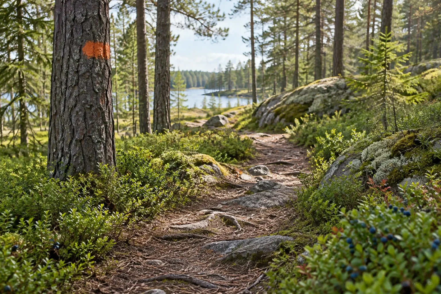
Sweden lets you walk almost anywhere, for free, without asking. What catches visitors out is everything around that freedom: two trail systems with different markings, a short mountain season, a statutory leash period and a few rules that override the right of access.
When you need this
You’re deciding between a forest or coastal trail and a mountain trip, or you’ve spotted a marking you don’t recognize — orange paint on a pine, a cairn, a red cross on a pole. Maybe you’re picking the month, bringing a dog, or wondering whether you can drink from that stream. This page covers what applies on every Swedish trail and points to the detailed guides.
Two kinds of trail
Swedish hiking splits cleanly in two, and most planning mistakes come from mixing them up.
| Lowland trails (låglandsleder) | Mountain trails (fjälleder) | |
|---|---|---|
| Where | Forest, farmland and coast, south and central Sweden | The fjäll along the Norwegian border, Dalarna to Norrbotten |
| Run by | Regions, municipalities and trail associations | Naturvårdsverket; county boards maintain trails, bridges and shelters |
| Size | Skåneleden alone is more than 1,600 km | About 5,500 km of state-marked trails |
| Stages | Day-length; Höga Kustenleden’s nine sections run 7.5–27 km | Huts about 10–20 km apart, a day’s walk |
| Services | Operator-dependent | Huts with no electricity or running water; help phones |
Three well-known lowland trails, as their operators describe them:
- Skåneleden in the far south, led by Region Skåne: more than 1,600 km in seven sub-trails and 148 stages.
- Sörmlandsleden, south of Stockholm, marked with orange rings on trees and posts.
- Höga Kustenleden (the High Coast Trail): about 135 km in nine sections from Hornöberget to Örnsköldsvik (older guides say 128 km in 13 stages).
In the mountains, Kungsleden is the classic hut-to-hut route; STF’s Kungsleden huts run from Abiskojaure to Viterskalet. Its own guide covers the route in detail. At the other extreme, Sarek National Park has no marked trails and no huts in its interior (only Kungsleden, with its STF huts, crosses the southern part) — it’s for experienced hikers only.
Reading the markings
There is no single national marking. The rule of thumb is simple, though: know which system you’re in.
| Marking | Where | Means |
|---|---|---|
| Orange squares, plates or paint on trees | Skåneleden | The trail; orange bands in some nature reserves |
| Orange marker with a cross | Skåneleden | You’ve gone the wrong way |
| Orange rings on trees and posts, S-arrows | Sörmlandsleden | The trail; blue marks on round loops |
| Small cairns (rösen), sometimes red-topped | Mountains, above the treeline | Summer trail |
| Painted rings or dots on trees | Mountains, birch forest | Summer trail |
| Red crosses on poles, about 40 m apart | Mountains | Winter route |
That last row is the trap. Winter routes cross frozen bog and lakes, so following red crosses in July can lead you into a wetland or straight toward a lake shore. Local trails run by municipalities, ski resorts or snowmobile clubs sit outside the state system and use their own markings.
The rules on every trail
Allemansrätten, the right of public access, lets you walk, hike and ski across land you don’t own, including private forest. The duty that comes with it is consideration: inte störa – inte förstöra, don’t disturb, don’t destroy. The Environmental Code requires that care of everyone in nature.
| Rule | Status |
|---|---|
| Walk anywhere on foot, including private forest | Guidance |
| Tent a night or two, away from homes and off farmland, 2–3 tents | Guidance; no statute states a day count |
| National parks and reserves: their own binding rules override the right | Law |
| Dogs 1 March–20 August: prevented from running loose where there is wildlife | Law; in practice a leash |
| Dogs in national parks: always on a leash | Law |
| Fire allowed with care; you are liable if it spreads | Guidance |
| Fire ban: no open fires, but gas and liquid camping stoves allowed | Law; breaches fined |
| Hunting is not part of the right, and “Jakt pågår” signs don’t close the forest | Guidance |
In the mountains, one more: a rest shelter (rastskydd) on the trail is for breaks and emergency nights, not a planned place to sleep. Outside the leash period a dog may be loose only if you can see it and stop it chasing wildlife. The full detail lives in our guides to allemansrätten, wild camping, campfires and fire bans and the leash law.
Choosing your season
The mountain calendar is short, and most of its dates are fixed by snow, huts and law.
| When | What changes |
|---|---|
| Late February – turn of April/May | STF mountain huts open for the ski season; winter routes in use |
| 1 March – 20 August | Statutory dog leash period |
| May – June | Snowmelt raises mountain rivers fast, especially in deep valleys |
| Mid-June – early August | Peak mosquitoes in mountain birch forest and bog; bare mountain milder |
| Midsummer – mid/late September | Summer hut season; northern mountain buses run June–September |
| Late August – September | Warm enough, and nearly mosquito-free in the mountains |
| Autumn | Hunting season — the forest stays open to walkers |
| From mid-December | Avalanche forecasts for six mountain areas |
Arriving outside the hut and bus seasons is the classic mountain mistake: the hut is closed and the bus may not run. See STF mountain huts for booking and Sweden without a car for trailhead transport.
Two health notes. Ticks carry TBE and Lyme disease; Folkhälsomyndigheten classifies TBE risk per municipality, so check before a forest hike. And mosquitoes peak in the mountains from mid-June to early August.
Maps, weather and water
Maps. Lantmäteriet, the national mapping agency, offers free map apps with no login. Naturkartan shows trails, reserves and their rules from about 170 municipalities, destinations and agencies; it’s run by a private company, OutdoorMap AB, and offline downloads need a free member account. A phone is not enough on its own in the mountains: cold drains batteries and coverage fails, so carry map and compass. Our offline maps guide walks through the downloads.
Weather. Mountain weather turns within hours, even in summer. Check SMHI’s warnings — yellow, orange and red, impact-based since 2021 — before a mountain day, and in winter and spring check lavinprognoser.se. The mountain safety guide covers river crossings, shelters and rescue.
Water. Municipal tap water is regulated drinking water everywhere in Sweden, so fill up before the trailhead. Mountain streams are another matter: no authority checks their quality, and clear water can carry stomach bugs. A Livsmedelsverket microbiologist, quoted by Friluftsfrämjandet, says it can be drunk if you know the risks — the basic advice is to boil it. Mountain huts have no running water.
If you get lost
Police advice, published in July 2026 for people heading into the forest:
- Before you go, tell someone where you’re going and when you’ll be back, and wear something bright.
- Stay calm and call 112 without delay. It’s free, even without a SIM card.
- Stay on a high or open spot where you can be seen.
- If you reach a road or larger path, stay on it.
- Listen for sirens and move toward them if it’s safe.
Much of the northern mountains has no mobile coverage. There, most overnight huts and many rest shelters have a help phone (hjälptelefon) connected to an alarm centre. Mountain rescue is run by the police and alarmed through 112.
Practical information
| Item | Detail |
|---|---|
| Access to trails | Free under allemansrätten |
| Lantmäteriet map apps | Free, no login |
| Naturkartan offline maps | Free member account required |
| Emergency | 112, free, with or without a SIM |
| STF mountain huts | Prices vary by season, area and trail; members pay 100 kr less — check STF |
| Hut seasons | Late February–turn of April/May; midsummer–mid/late September; dates vary by area |
| Dog leash period | 1 March–20 August |
FAQ
Do I need a permit to hike in Sweden?
No. Under allemansrätten you may walk and hike across land you do not own, including private forest, without asking and without paying. The duty is to not disturb and not destroy. National parks and nature reserves have their own binding rules, which can limit camping, fires or dogs, so check them before a trip.
What do the trail markings mean in Sweden?
It depends on the trail. Lowland trails such as Skåneleden and Sörmlandsleden use orange paint, squares or rings on trees and posts. Mountain summer trails use small cairns, sometimes red-topped, and painted marks on trees in birch forest. Red crosses on poles mark winter routes and can lead into bog or lakes in summer.
When is the best time to hike in Sweden?
For the mountains, late June to September, when STF huts are open; late August and September have far fewer mosquitoes than mid-June to early August. May and June bring snowmelt and high rivers. Lowland trails in the south can be walked outside the mountain season, and huts open again for skiing from late February.
Can I bring my dog hiking in Sweden?
Yes, with rules. From 1 March to 20 August a dog must be prevented from running loose where there is wildlife, which in practice means a leash. In national parks the leash is required all year. Outside that period a dog may be loose only if you can see it and stop it chasing wildlife.
Can I drink water from streams when hiking in Sweden?
No authority checks the quality of mountain stream water, and clear water can carry bacteria or viruses that cause stomach illness. A Livsmedelsverket microbiologist says it can be drunk if you know the risks; the basic advice is to boil it. Tap water in towns is regulated drinking water, so fill up before the trailhead.
What should I do if I get lost hiking in Sweden?
Stay calm and call 112 without delay; it is free, even without a SIM card. Police advise staying on a high or open spot where you are easy to see, staying on any road or larger path you reach, and moving toward sirens if safe. In the mountains without signal, use a hut or shelter help phone.
Are Swedish forests closed during hunting season?
No. Hunting is not part of allemansrätten, but allemansrätten still applies while a hunt is on: you may walk and pick berries as long as you do not disturb the hunt significantly. “Jakt pågår” signs are a warning, not a closure. Police advise bright clothing or a reflective vest in the autumn forest.
Related guides
- Mountain safety in the Swedish fjäll — preparation, rivers, help phones and rescue
- STF mountain huts and stations — booking, bedding and seasons
- Kungsleden — the classic hut-to-hut route
- Wild camping in Sweden — where and how long you may pitch a tent
- Sweden without a car — trains and buses to the trailhead
Facts verified 2026-09-24. Sources: Naturvårdsverket, Fjällsäkerhetsrådet, the Swedish Police Authority, the dog supervision act, Lantmäteriet, SMHI, SOS Alarm, STF and the trail operators of Skåneleden, Sörmlandsleden and Höga Kustenleden — full register in this topic’s source file. Found something outdated? Tell us and we’ll fix it.