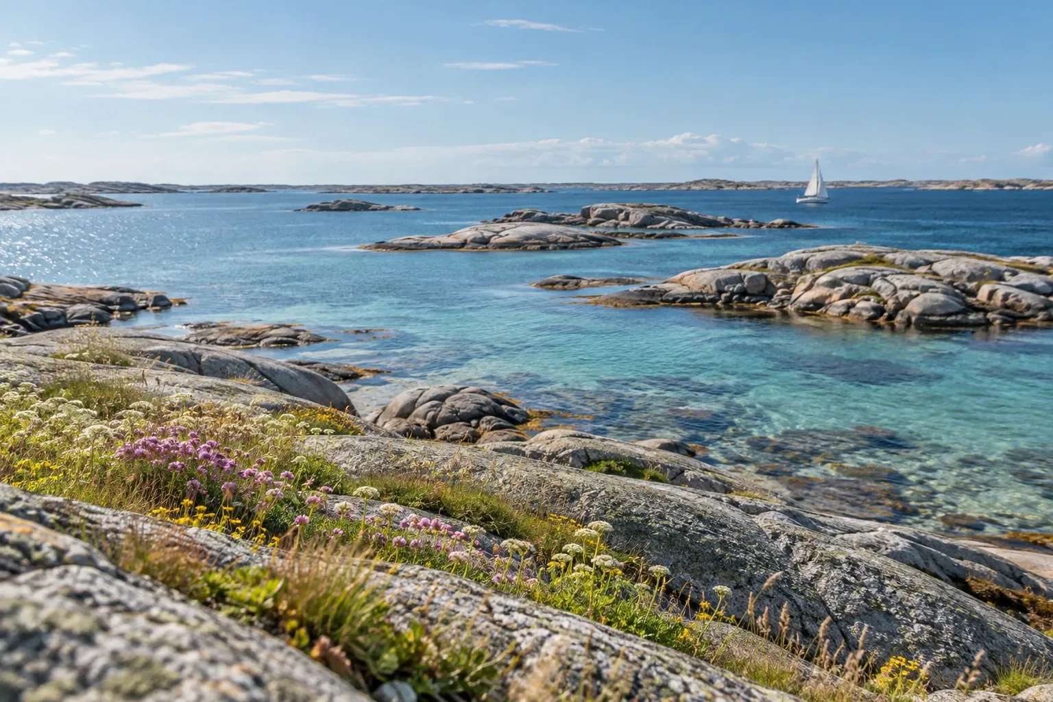
Strömstad is where the Swedish west coast runs out. Here’s how to get there while the railway is closed, how the ferry to Norway works now, where to park a car or motorhome, and what to see beyond the Koster boats and the shopping.
When you need this
- You’re deciding whether Strömstad is worth a night on a west-coast trip
- You’re traveling to Strömstad by public transport in late 2026
- You want the ferry between Strömstad and Norway, or to drive on to Oslo
- You need to park a car or a motorhome in town, or for the Koster boats
- You want the sights around Strömstad that aren’t Koster or shopping
Strömstad at a glance
Strömstad is the northernmost town on Sweden’s west coast. The municipality has about 13,500 residents, borders Norway, and describes itself as midway between Oslo and Gothenburg. Second-home owners multiply the population for much of the year.
| Fact | |
|---|---|
| From Gothenburg | 166 km on the E6, about 2 h 5 min |
| From Oslo | 136 km, about 1 h 45 min |
| To the Svinesund border | 21 km, about 20 min |
| Trains | None until 12 December 2026; replacement buses |
| Ferry to Norway | Color Line to Sandefjord, about 2.5 h |
| Koster boats | Västtrafik line 899, year-round, about 45 min |
Distances are our own route measurements, pure driving time without stops.
Getting there in 2026
By car, it’s simple: the E6 runs from Gothenburg to Strömstad in about two hours. The slow coastal alternative, with Smögen, Fjällbacka and Tanum on the way, is our west coast road trip.
By public transport, read this before you book. The railway to Strömstad, Bohusbanan, is being rebuilt, and trains don’t reach the town in 2026:
| Stretch | What runs | Until |
|---|---|---|
| Dingle – Strömstad | Replacement bus (ersättningsbuss) | 12 December 2026 |
| Gothenburg – Stenungsund | Replacement buses | 14 March 2027 |
| Whole line Strömstad – Gothenburg | Trains again, according to Tanum municipality | from 15 March 2027 |
Trafikverket’s own project page names the closed stretch as Dingle–Strömstad in one section and Rabbalshede–Strömstad in another. The operator’s notice says Dingle, so plan on a bus from there. No source we read confirms what runs between 13 December 2026 and 14 March 2027, so check that window in Västtrafik’s journey planner. Our Tanum rock carvings guide covers the same closure from the Tanum end.
On to Norway
By road, Svinesund is 21 km away. The bridge has been toll-free since 15 March 2021, and Svinesund is a designated customs office: Norway is in Schengen but outside the EU, so it’s an internal border for passports and a full customs border for goods.
By sea, Color Line sails from Strömstad to Sandefjord in about 2.5 hours, with several departures a day, and carries cars, caravans and motorhomes. Only Color Line. Fjord Line also ran this route until it pulled out in October 2023, but ferry booking sites still list it. Don’t go looking for that sailing.
Three things catch people out on the way into Norway:
- The tax-free shop on board doesn’t help on a day trip. On trips under 24 hours, Norway’s alcohol and tobacco quota only covers goods taxed in an EEA country. Systembolaget in Strömstad counts; the ferry’s tax-free shop doesn’t. Goods over the quota are confiscated and fined.
- Carry a passport or national ID card. Polisen recommends one even where a Nordic driving licence is usually accepted. Both countries notified temporary internal border controls from 12 May to 11 November 2026: Sweden’s covers all internal borders, and Norway’s covers ports with ferry connections to the Schengen area, which includes Sandefjord. Check whether either has been renewed.
- The quotas are their own subject. Read the Sweden–Norway border guide before you shop, and border shopping if you’re wondering why Strömstad’s shops are full of Norwegians. The Strömstad area, with Svinesund and Nordby, took half of all Norwegian day-trip spending abroad in 2025.
Parking and motorhomes
Strömstad’s parking is tiered by type of car park and by season. The municipality’s rules:
| Car park type | Limit | When you pay |
|---|---|---|
| 3-hour (central) | 3 hours | Weekdays 9–18, Saturdays 9–15; a free first hour from October to March |
| 24-hour | 24 hours | Same hours, May–August |
| 7-day | 7 days | By car park |
| Long-stay | No limit 15 September – 15 May | Mid-June to mid-August; otherwise free 24-hour parking |
Sundays and public holidays are free. Payment zones work in the EasyPark and Parkster apps.
For the Koster boats, use a 24-hour, 7-day or long-stay car park, never a 3-hour bay. The nearest 24-hour car park to the boats is Skeppsbroplatsen; the nearest 7-day one is Canning. The long-stay car parks are about 20 minutes’ walk out. In summer a free parking bus links them with the centre, stopping at the station and the Color Line terminal. In 2026 it ran 15 June to 16 August, 08:10–20:10, every 40 minutes, and about every 20 minutes from 29 June to 2 August. Those extra peak departures weren’t in the timetable or the app, and the municipality warned of delays.
Motorhomes have a municipal stopover site (ställplats) at Bojarparkeringen on Kebalvägen, about 1.7 km from the centre:
- Motorhomes only, not caravans
- At most two days (dygn, 24-hour periods), first come first served, no booking
- No wheel outside a marked space
- Toilet, fresh water and toilet-waste emptying from 15 March to 15 October, frost permitting
- A fee in that season, paid by coin, card or app; free from 16 October to 14 March
If you need longer, the municipality points you to its campsites. The overnight RV parking guide explains how Swedish stopover rules work in general.
The town
Strömstad is a border creation. When Bohuslän became Swedish in 1658, the main trading places ended up on the Norwegian side. Strömstad became a market town (köping) in 1667 and a town in 1672, and Karl XI confirmed its privileges in 1676. It was Karl XII’s headquarters in the war against Norway in 1716–1718, and a Danish naval force under Tordenskjold attacked it twice in 1717.
Then it became a spa resort (kurort). The municipality dates Sweden’s first hot-bath house here to 1786, and royal visits in the 1800s made Strömstad one of the country’s most popular spa towns. Two traces are easy to find:
- Strömsdalen, the valley laid out in the mid-1800s as a promenade for spa guests, is now a nature park.
- The cold-bath house on the harbour is a new one, opened in 2005; the 1888 original was lost to a storm in 1968.
Strömstads museum tells the town’s story from a former 1880s mill storehouse by the Strömsån river. The tourist board lists summer opening and free entry, but its hours carry no year, so check before you go. Hikers note: Bohusleden, the 27-stage, roughly 350 km trail up through Bohuslän, ends in Strömstad; see the Bohusleden guide.
The northernmost coast
The municipality runs from the Tanum boundary, in the water just south of Rossö, to Svinesund. Here’s what’s in it besides the Koster Islands:
| Place | From Strömstad | Why go |
|---|---|---|
| Tjärnö and Saltö | 13 km, about 17 min | Bridged islands, a sandy beach at Svallhagen, the university aquarium, a Kosterhavet entrance |
| Rossö | 18 km, about 25 min | Harbour village of about 330 residents; a Kosterhavet entrance |
| Blomsholm | about 7 km northeast | Iron Age stone ship and stone circle |
| Skee | inland, near Blomsholm | Church from the 1100s |
| Hogdal | about 10 km northeast | Church on Hogdalsnäset; Halle-Vagnaren nature reserve with old forest |
| Svinesund | 21 km, about 20 min | The border since the 1600s; two bridges, the newer from 2005 |
Tjärnö Aquarium belongs to the University of Gothenburg’s marine laboratory. It’s small, but it shows a little over 200 species of animals and algae, with a touch pool. It opens to the public in summer only; the rest of the year it takes booked groups.
Blomsholm is the one to stop for on the way to Norway. The stone ship (skeppssättning) is over 40 meters long and made of 49 stones. The largest stone circle (domarring) is 36 meters across, and about 160 graves lie in seven grave fields; some graves are dated to AD 400–600. Parking by the road is free, but park only at the marked spot, because the land around it is private.
Kosterhavet National Park has four mainland entrances you can drive to: Strömstad, Saltö, Resö and Rossö. All are accessible to wheelchair users. Its rules bind everywhere in the park: no oyster picking, fires only at prepared sites, no overnight stay or anchoring in one place for more than two days, no drones, and keep 100 m from bird sanctuaries from 1 March to 31 August. Swedish national parks puts it in context.
Seasons
| When | What changes |
|---|---|
| 20 April – 12 December 2026 | No trains to Strömstad; replacement buses from Dingle |
| 15 March – 15 October | Motorhome site fee and services |
| May – August | Fees at the 24-hour car parks |
| Mid-June – mid-August | Long-stay fees; free parking bus |
| Summer only | Tjärnö Aquarium open to the public |
| 1 March – 31 August | Kosterhavet bird sanctuaries, 100 m |
| Easter and Norwegian holidays | Border-shopping peaks |
| January 2027 | The Koster Islands join Västtrafik’s zone C |
Practical information
| Item | Detail (checked 15 October 2026) |
|---|---|
| Summer parking bus | Free |
| Motorhome site, Bojarparkeringen | Fee 15 March – 15 October, free 16 October – 14 March; amount at the machine |
| Town car parks | Fees by car park and season; Sundays and public holidays free |
| Tjärnö Aquarium, 2026 | Adults (16+) SEK 70, children 7–15 SEK 35, under 7 free; weekdays 14–17, 29 June – 14 August, plus 24 June and 19 August |
| Strömstads museum | Free entry, per the tourist board |
| Blomsholm | Free, with free parking |
| Svinesund bridge | Toll-free |
| Koster boats, replacement buses | Västtrafik fares in its journey planner |
| Color Line to Sandefjord | Fares from the operator |
FAQ
How do I get to Strömstad from Gothenburg without a car?
By Västtrafik’s Bohusbanan service, but not by train all the way in 2026. From 20 April to 12 December 2026, buses replace trains between Dingle and Strömstad, and buses also replace trains between Gothenburg and Stenungsund until 14 March 2027. Tanum municipality says through trains return on 15 March 2027. Plan the whole trip in Västtrafik’s journey planner.
Is there a ferry from Strömstad to Norway?
Yes. Color Line sails between Strömstad and Sandefjord, about two and a half hours, with several departures a day, and takes cars, caravans and motorhomes. Fjord Line also ran the route until October 2023 but has stopped, so ignore older listings. Tax-free purchases on board do not count toward Norway’s day-trip quota for alcohol and tobacco.
How far is Strömstad from Oslo and the Norwegian border?
Strömstad to the Svinesund border crossing on the E6 is about 21 km, roughly 20 minutes of driving. Oslo is 136 km, about one hour 45 minutes, and Gothenburg 166 km, about two hours. These are our own route measurements without stops or queues. The Svinesund bridge has been toll-free since 15 March 2021.
Can I park a motorhome overnight in Strömstad?
Yes, at the municipal motorhome site at Bojarparkeringen on Kebalvägen, about 1.7 km from the centre. It is for motorhomes only, not caravans, for at most two days, first come first served. A fee applies from 15 March to 15 October, when toilet, water and waste emptying are open; the rest of the year it is free.
Where do I park in Strömstad for the Koster boats?
In a 24-hour, seven-day or long-stay car park, not a three-hour bay. The municipality names Skeppsbroplatsen as the nearest 24-hour car park to the Koster boats and Canning as the nearest seven-day one. Long-stay car parks are about 20 minutes’ walk out, and a free parking bus links them with the centre in summer.
What is there to see around Strömstad besides Koster?
Blomsholm, 7 km northeast, has an Iron Age stone ship over 40 metres long and a large stone circle. Tjärnö’s university aquarium shows over 200 marine species in summer. Saltö and Rossö are mainland entrances to Kosterhavet National Park. In town, there is the spa-era Strömsdalen park and Strömstads museum.
Do I need a passport to go from Strömstad to Norway?
Carry a passport or national ID card. Norway is in Schengen, but both countries notified temporary internal border controls running to 11 November 2026: Sweden’s covers all internal borders, Norway’s covers ports with ferry connections to the Schengen area, which includes Sandefjord. Goods are checked separately, because Norway is outside the EU customs union.
Related guides
- Koster Islands — the day trip from Strömstad’s harbour, and the island rules
- Sweden–Norway border — quotas, Kvoteappen and ID before you cross
- Border shopping — why Norwegians shop in Strömstad, in numbers
- West coast road trip — the coastal drive that ends here
- Tanum rock carvings — World Heritage, about 30 minutes south
Facts verified 15 October 2026. Sources: Strömstads kommun, Tanums kommun, Länsstyrelsen Västra Götaland, Trafikverket, Västtrafik, Color Line, Göteborgs universitet, Tullverket, Tolletaten, Polisen, Statistics Norway, the European Commission and West Sweden’s tourist board; distances measured with OSRM. Full register in this topic’s source file. Found something outdated? Tell us and we’ll fix it.