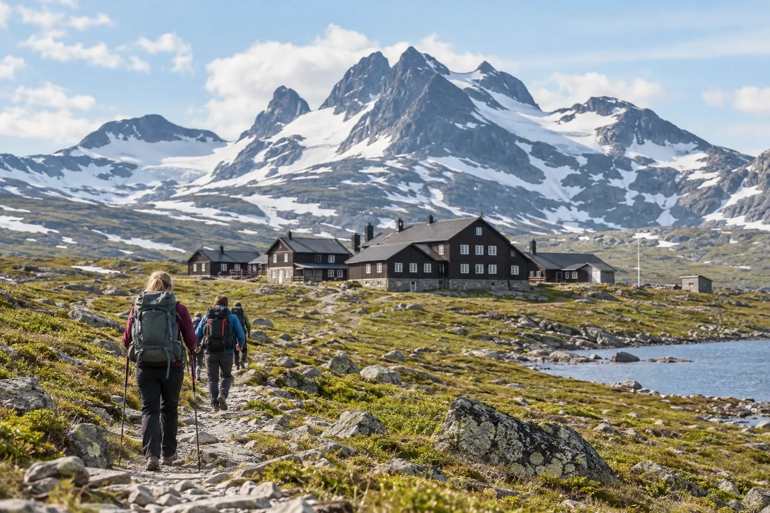
The Triangle is one of Sweden’s classic mountain walks: three days, three staffed stations, no tent needed. But it changed in 2024, and most of what you’ll read online still describes the old version. Here’s how it works now.
When you need this
You’re picking dates and wondering why the stations seem to open so late. Or you’ve booked the train and want to know which direction to walk, what to carry and how to pay at stations with no road. Or you’re weighing the Triangle against a longer trail like Kungsleden, which is a different walk 450 km long, up in Lapland.
The loop at a glance
Jämtlandstriangeln (“the Jämtland Triangle”) is a loop in western Jämtland between three mountain stations run by the Swedish Tourist Association (STF): Storulvån, Sylarna and Blåhammaren. STF puts the total at 47 km in three stages, 4–8 hours of walking a day, and says it suits both first-timers and experienced hikers.
| Stage | Length | Walking time | Character |
|---|---|---|---|
| Storulvån – Sylarna | 16 km | 5–7 h | Birch forest, then a gentle climb on open fell |
| Sylarna – Blåhammaren | 19 km | 6–8 h | Longest and most exposed; stony and windy; ends uphill |
| Blåhammaren – Storulvån | 12 km | 4–5 h | Mostly downhill; one wade; ends in birch forest |
The county board measures the first stage at “just over 15 km”, so don’t worry if your map disagrees slightly. The trails belong to the state trail system: the county board (Länsstyrelsen Jämtland) looks after the trails, bridges, rest shelters and help phones, and STF runs the stations. Only Storulvån has a road. Sylarna is 16 km from it, and Blåhammaren is roadless too.
When you can walk it: the mid-July window
This is the part older guides get wrong. In 2023, STF and the Sámi reindeer-herding villages (samebyar) reached an agreement, which the county board approved that December. Since 2024 the Jämtland stations open later in summer so that hikers don’t disturb reindeer during calving. Blåhammaren’s restaurant closed and beds at Blåhammaren and Sylarna were cut.
The practical result: the three stations open on different dates, and Sylarna opens last, in mid-July. A hut-to-hut loop only works when all three are open, so a midsummer or early-July plan leaves you without a bed in the middle. The exact dates for next season are in the Practical information table.
Within that window, STF’s visitor calendar marks the stations busiest from about week 29 to week 33, roughly mid-July to mid-August. From week 34 it gets quieter, except Thursday to Saturday.
Stage by stage
Day 1: Storulvån to Sylarna (16 km). STF suggests sleeping at Storulvån the night before; you can rent gear there. The first kilometres run through mountain birch forest (fjällbjörkskog). After the suspension bridge over Lill-Ulvån you’re on the open fell (kalfjäll) the rest of the day, climbing gently, with the Sylarna massif ahead. The Spåjme wind shelter, about 8 km in, is the natural break.
Day 2: Sylarna to Blåhammaren (19 km). The longest day starts with a descent towards the Enan river, then rolls up and down over stony, often very windy ground. Turn around after the first climb for the view back to Sylarna. The Enkälen shelter sits about halfway. About 4 km before Blåhammaren you may have to wade a stream at high water, and the day ends uphill.
Day 3: Blåhammaren to Storulvån (12 km). The easiest stage, mostly downhill or flat. The Ulvåtjärn shelter comes after about 6 km. Then the trail crosses a stream you wade, runs over an old lake bed from the last ice age and ends in birch forest.
You can walk it the other way round. Most people go Storulvån–Sylarna–Blåhammaren, which puts the longest stage in the middle. Reversed, you start with the short climb to Blåhammaren and finish with a flatter day down from Sylarna. If you have a spare day, spend it at Sylarna: it sits by Sweden’s southernmost glacier, and STF suggests climbing Syltoppen.
Booking, food and paying
Book early. STF says the Triangle stations are often fully booked in high season. If a station fills in bad weather, it may offer emergency floor beds, but you shouldn’t plan on one.
| Station | Restaurant | Self-catering and shop | Payment on site |
|---|---|---|---|
| Storulvån | Yes, licensed; prebook dinner | Yes | Check with STF |
| Sylarna | Yes; prebook dinner | Yes | Card only, or prepay |
| Blåhammaren | No | Yes | Card only, or prepay |
Two things catch people out. First, Sylarna and Blåhammaren are cashless (kontantlöst), so the classic mountain-hut advice to carry kronor doesn’t help there; bring a card or pay in advance. Second, Blåhammaren has no restaurant, so you cook in its kitchen or buy food in its shop. Sylarna’s restaurant may not last either: a county board presentation from March 2024 says the restaurants at Sylarna and Helags are to close by 2028 at the latest. STF still lists one at Sylarna.
You carry lunch for every stage. STF says you can take water from streams along the way. For booking, bedding and payment at STF facilities in general, see our guide to STF mountain huts.
Weather, wading and markings
STF is blunt about the weather: sub-zero temperatures and snowfall happen even in summer, and the Sylarna–Blåhammaren stage is especially exposed to wind. Pack rain and wind gear whatever the forecast says, ideally a bivvy bag, and ask at the station about conditions before each day’s stage.
Wading is the other hazard. There are two wading points, one near Blåhammaren on day 2 and one on day 3. The county board notes that streams rise fast after heavy rain, so a stream that looks small on the map can become difficult. Fjällsäkerhetsrådet, the state mountain-safety council, gives a simple rule:
- Don’t wade fast-moving water that comes above your knees.
- Undo your hip belt and chest strap first, so the pack comes off if you fall.
- A wading pole helps; get one before the trip.
The Triangle uses the state trail markings. Summer trails have orange-red paint on stones, cairns, trees or posts. Winter routes have red crosses on poles (ledkryss), and summer and winter routes can take different lines, so follow the markings for the season you’re in. Signposts are blue with white text. STF names the Fjällkartan app and Lantmäteriet’s map Z54, and says its online map is for planning only, not a replacement for a map and compass.
On the safety side, Telia’s network is often usable in the Storulvån–Sylarna–Helags area, and most rest shelters on the state trails have a help phone. The shelters are for breaks and emergencies, not planned nights. Emergency boxes with food, first aid and repair kits are stocked in the Sylarna–Helags area. Our mountain safety guide covers the system in full.
Tent, dogs and reindeer
You can do the Triangle with a tent. STF says allemansrätten applies on most of the trail. Near a station you pay a tent and service fee on site, which gets you the kitchen, sauna and toilets while the station is open. Our wild camping guide has the general rules.
Reindeer are herded throughout the area. Jämtland has 11 Sámi villages, and disturbing reindeer or herding is prohibited under the Reindeer Husbandry Act. The animals are most sensitive at calving in April–May, and again when herds are gathered for calf marking, slaughter or moves. If you bring a dog, Swedish law requires a lead wherever reindeer graze, in any month; the stations have a limited number of pet rooms. More in our guides to reindeer in Sweden and the leash law.
Mosquitoes are worst in the birch forest and near bogs. The windy open fell, where most of the Triangle runs, is usually fairly free of them. See our mosquito guide.
Getting to Storulvån
Storulvån is at the end of a road, about an hour from Åre. By train, travel to Duved or Enafors and book a bus or taxi transfer to the station. SJ’s night train from Stockholm runs to Duved, but its contract is fixed only until mid-June 2027, so check summer departures before you plan around it. By car, take the E14 and follow signs from Enafors; there’s parking and EV charging. The nearest airports are Åre Östersund and Trondheim. For the car-free picture, see Sweden without a car.
The Triangle in winter
The Triangle is also a classic ski route of about 47 km. STF recommends touring skis with steel edges, which you can rent at Storulvån, and the stations have a separate winter season. In winter the road between Handöl and Storulvån closes at night and can close by day in bad weather. Naturvårdsverket’s avalanche forecast for the southern Jämtland mountains covers Storulvån and Sylarna. For skiing near Åre, see our Åre guide.
Practical information
| Item | Detail |
|---|---|
| Route | Storulvån – Sylarna – Blåhammaren – Storulvån, 47 km, 3 stages |
| Summer 2027 opening (STF) | Storulvån 24 June–3 October; Blåhammaren 1 July–26 September; Sylarna 15 July–26 September |
| Winter 2027 opening (STF) | Storulvån 25 February–18 April; Sylarna and Blåhammaren 5 March–18 April |
| Winter road Handöl–Storulvån | Closed 22.00–08.00 from 1 February to 15 April |
| Payment | Sylarna and Blåhammaren cashless: card or prepay |
| Restaurants | Storulvån and Sylarna (prebook dinner); none at Blåhammaren |
| Tent near a station | Tent and service fee, paid on site |
| Maps | Fjällkartan app; Lantmäteriet Z54 |
| Night train to Duved | Contracted to 13 June 2027; summer 2027 depends on an option |
| Trail news | Länsstyrelsen Jämtland, Aktuellt i fjällvärlden |
The county board posts trail work there. In 2026 it graveled worn sections of Storulvån–Sylarna, finishing in September, and renovated about 4.5 km of boardwalk around Blåhammaren.
FAQ
How long is the Jämtland Triangle hike?
STF puts it at 47 km, usually walked in three days between its Storulvån, Sylarna and Blåhammaren stations: 16 km to Sylarna, 19 km on to Blåhammaren and 12 km back to Storulvån. Each day takes four to eight hours. The middle stage is the longest and most exposed, so allow a spare day for weather.
When can you hike the Jämtland Triangle?
As a hut-to-hut walk, only when all three stations are open. In 2027 Sylarna opens last, on 15 July, and Sylarna and Blåhammaren close on 26 September. The stations have opened later since 2024 to protect reindeer calving. With a tent you can start earlier, but the stations’ kitchens and saunas stay closed.
Which direction should you hike the Jämtland Triangle?
Most hikers go Storulvån, Sylarna, Blåhammaren and back to Storulvån, which puts the longest stage in the middle and the shortest last. The reverse works equally well: you start with the short climb to Blåhammaren and finish with a flatter day down from Sylarna. Either way, STF suggests sleeping at Storulvån the first night.
Do you need to book the mountain stations?
Yes. STF says the stations on the Triangle are often fully booked in high season, from about mid-July to mid-August, and dinners at the Storulvån and Sylarna restaurants must be booked too. Blåhammaren has no restaurant, only a shop and self-catering kitchen. Pay by card or in advance: Sylarna and Blåhammaren take no cash.
Can you hike the Jämtland Triangle with children?
Yes, with the right expectations. STF says the 12 to 19 km stages, up to eight hours for an adult, are long for young children, and bad weather makes them longer. It suggests day walks from Storulvån first for a family’s first mountain trip. Stage three includes a wade, so pack spare socks and shoes.
How do you get to the Jämtland Triangle without a car?
Take the train to Duved or Enafors, then a booked bus or taxi transfer to Storulvån, where the loop starts and ends. SJ’s night train from Stockholm runs to Duved, under a contract that is fixed only until 13 June 2027, so check summer 2027 departures before you plan. The nearest airports are Åre Östersund and Trondheim.
Can you camp on the Jämtland Triangle?
Yes. STF says allemansrätten applies on most of the trail, though reindeer are herded throughout the area. Camping near a station costs a tent and service fee, paid on site, which gives you the kitchen, sauna and toilets. Keep a dog on a lead where reindeer graze, and use rest shelters only for breaks or emergencies.
Related guides
- Jämtland in summer — Åre, Östersund and the rest of the region around the Triangle
- STF mountain huts — how booking, bedding and payment work at STF facilities
- Mountain safety in Sweden — fords, help phones and rest shelters before you set off
- Kungsleden — the longer hut-to-hut trail in Lapland, if three days leave you wanting more
- Reindeer in Sweden — why the stations now open later
Facts verified 2026-10-14. Sources: Svenska Turistföreningen (STF), Länsstyrelsen Jämtland, Fjällsäkerhetsrådet, Naturvårdsverket, Sveriges riksdag, SJ — full register in this topic’s source file. Bed, dinner, tent-fee and transfer prices change each season and are deliberately not published here. Found something outdated? Tell us and we’ll fix it.