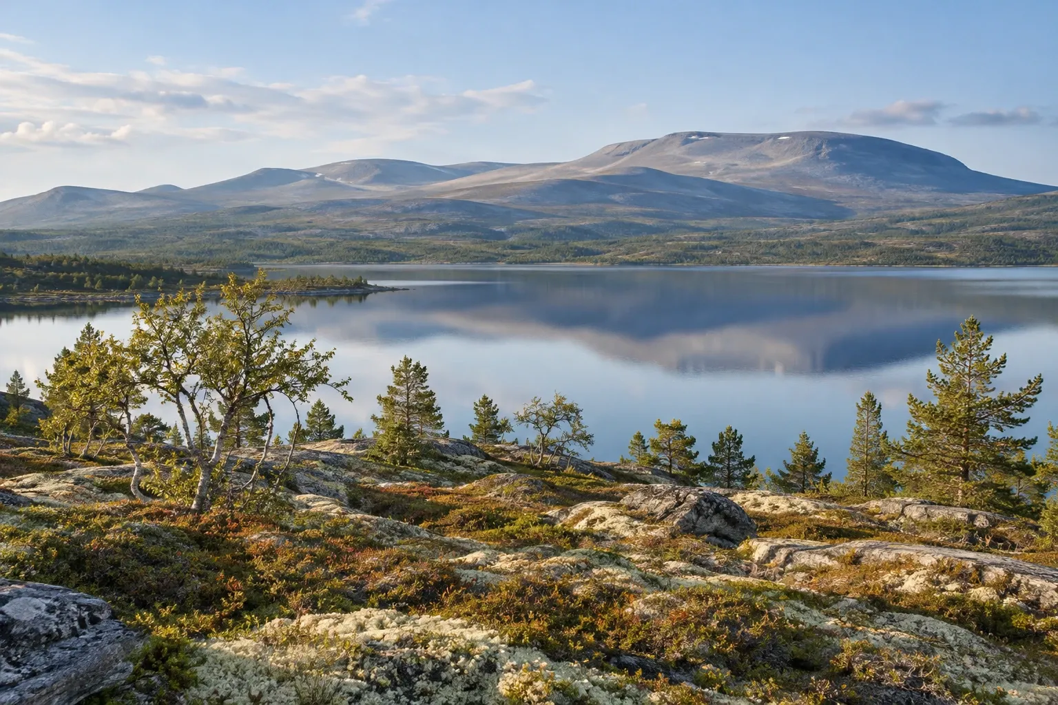
North of Mora, Dalarna turns into one long road through forest to the bare fells on the Norwegian border. Here’s what lies along it, which rules apply in the nature reserves, and how to reach it all with or without a car.
When you need this
You’re choosing between Sälen and Idre, or wondering what lies beyond Mora. Maybe you want the Grövelsjön or Idre fells for a summer hike or a winter ski trip, or you’re set on Töfsingdalen, one of Sweden’s least visited national parks. Or you’re travelling without a car and need to know how far bus 396 really takes you, or you’re driving on into Norway.
One road, four places
In this guide, “northern Dalarna” means the upper Österdal valley north and west of Mora — in practice the municipality of Älvdalen. It is the county’s emptiest corner: 6,908 km² of land, about a quarter of Dalarna, with 6,799 inhabitants in mid-2026. That works out at roughly one person per square kilometre.
Riksväg 70 and Dalatrafik’s bus line 396 tie it together. Our own routing measurements (pure driving time) give these distances:
| Place | From Mora by road | What it is for a visitor |
|---|---|---|
| Älvdalen (town) | 40 km, about 40 min | The municipal centre: the porphyry museum, Rots skans, the älvdalska language |
| Särna | 121 km, about 1 h 50 min | Gateway to Fulufjället National Park and Njupeskär |
| Idre | 152 km, about 2 h 20 min | The hub: the ski area, Städjan and Nipfjället, reindeer country |
| Grövelsjön | 191 km, about 3 h | Mountain station at the end of the road; Långfjället, Töfsingdalen, the Norwegian border |
From further away, Stockholm–Idre is 467 km (about 6 h 40 min) and Sälen–Idre 100 km (about 1 h 40 min). Idre is not a day trip from Mora: plan to stay in the area.
Idre and Städjan
Idre is where most visitors base themselves. In winter the draw is the Idre Fjäll ski area, whose regular 2026/27 season runs from 19 December 2026 to 4 April 2027 with a snow guarantee: at least 10 runs and 2.5 km of cross-country track open, or you can cancel from three days before arrival for a refund. Cross-country skiers can start much earlier — tracks on stored snow open on 23 October 2026, and alpine skiing is provisionally planned from early December. The ski area’s own pages say it is run by a foundation.
In summer, the landmark is Städjan (1,131 m), named for its anvil-shaped (städ) silhouette. The Städjan-Nipfjället nature reserve starts about 8 km north-east of Idre, and the road climbs right onto the open fell, which makes it one of Dalarna’s most accessible mountains:
- To the top: about 3 km from Städjan’s gravel car park (room for about 40 cars, not ploughed in winter), 6 km return. Orange paint marks the summer trail; red crosses on poles mark the winter trail.
- The final 800 m is very steep on loose gravel, then blocky ground where you use your hands. On clear days you see Grövelsjön, the Norwegian border or Fulufjället.
- Trollvägen, the road between the Nipfjället summer and winter car parks, is a famous optical illusion: stop at the sign, release the brake, and the car seems to roll uphill.
The reserve has binding regulations (föreskrifter). Drones, model aircraft, paragliders and kites may not fly below 300 m. In the marked area you may pitch tents and light fires only at county-board sites, and camping, motorhomes and parking over 24 hours are allowed only at designated places. You may gather small loose branches for a fire, but not dead standing trees, logs or resin stumps.
Grövelsjön, Långfjället and Töfsingdalen
At the end of the road, Grövelsjön’s mountain station sits inside the Långfjället nature reserve: three fell ridges around 1,000 m high, rising to Storvätteshågna, 1,204 m, the highest point in Svealand. Many summer, winter and snowmobile routes start at Grövelsjön and Lövåsen, Södra Kungsleden passes through, and pines older than 500 years grow in several places. An easy walk or ski for all ages leads to Valdalsbygget, an old fäbod (summer farm) right on the border, where you can stand with a foot in each country.
Långfjället’s rules are stricter than plain allemansrätten (the right of public access) in one zone:
| Rule | Where it applies |
|---|---|
| Tents and fires only at prepared sites (shelters and lean-tos) | The marked zone around Hävlingen, Storån and Töfsingdalen |
| No tents near the county board’s rental cabins | Whole reserve |
| Snowmobiles on marked trails only; Grövelsjön–Hävlingen and Hävlingen’s ice to 25 April | Whole reserve |
| Other snowmobile trails and Grövelsjön’s ice to the first Sunday in May | Whole reserve |
| No combustion-engine ice augers, no rock climbing | Whole reserve |
Töfsingdalen National Park, founded on 29 March 1930, protects a boulder field and conifer forest known for its old silver-grey pines. No road reaches it and there are no trails across the boulders, so expect slow, demanding going. Two ways in:
- Hävlingen: 13 km, about 3.5 hours, on foot or skis from Grövelsjön’s mountain station. The county board rents whole cabins at Hävlingen, plus one overnight hut by the bed.
- Ängessildret: 8 km to the park boundary from a car park on a gravel road from Foskros. The road is ploughed only to Hällsjön, and there is no marked winter route.
Fishing is banned inside the park but allowed outside it in Storån and Hävlingen. Watch for varglav (wolf lichen) on old pine snags: it is poisonous, so leave it on the tree.
Älvdalen and Särna
The valley villages are a different Dalarna. In central Älvdalen, Porfyr- och Hagströmmuseet shows objects carved from local porphyry and the accordions and guitars made in Älvdalen from 1925 to 1983 — more than 700,000 accordions and 120,000 guitars. Rots skans, a fort built in 1677 against attack from Norway (then Danish), is now a heritage site of about 25 buildings.
Listen and you may hear älvdalska (övdalska). The municipality says up to about 3,000 people speak it and many regard it as a Nordic language of its own; it has its own ISO code but no minority-language status in Sweden. Our Swedish dialects guide puts it in context.
Särna is the gateway to Fulufjället, where Njupeskär drops 93 m, 70 m of it in free fall. Our Fulufjället and Njupeskär guide covers the park in full. Three km north of Särna, the forest and defence museum at Lomkällan includes an intact Second World War battalion fortification.
Sápmi and the reindeer
In Sweden, Sápmi — the Sámi homeland — runs from Idre northward. Långfjället lies on the lands of Idre sameby (Sámi reindeer-herding community), which uses them all year with about 2,000 reindeer plus calves. The county board points out that disturbing reindeer is not allowed under the Reindeer Husbandry Act, and asks for extra care during calving, from mid-April to mid-June. In spring 2023 it asked skiers to avoid mountains where pregnant reindeer grazed. Our reindeer herding land guide explains how to behave around a herd.
Getting there without a car
It’s possible, but it needs planning:
- Bus 396 runs Mora – Älvdalen – Särna – Idre – Grövelsjön all year; Mora to Grövelsjön takes about three and a half hours. In the 17 August – 12 December 2026 timetable some trips run only on school days and some must be booked by phone, at least three hours ahead or by 18:00 the day before. Read the timetable notes.
- Pay by Visa or Mastercard, a travel card or the app; cash is not listed. See paying for buses in Sweden.
- In winter, Fjällexpressen’s Stockholm coach (via Uppsala, Gävle, Falun, Rättvik, Mora, Sälen and Särna) stops in Idre, at the ski area and at Grövelsjön, from 17 December 2026 to 11 April 2027.
- Flex lines: line 785 from Särna to Fulufjället and line 782 from Idre to the Foskros area run on set days and only when booked.
One trap: Scandinavian Mountains Airport near Sälen lists transfers to Sälen and Trysil, not Idre, warns that taxis are limited, and says no public transport serves the airport. Arrange a car or transfer before you fly. Our fjäll by public transport guide covers the train-and-bus chain in more detail.
Driving? Winter tyres are required from 1 December to 31 March whenever there are winter road conditions, foreign cars included. Mobile coverage on the fell can never be guaranteed, says the county board, so carry an offline map and leave a trip plan. Heading on into Norway, Idre is a designated road customs office; see the Sweden–Norway border.
Season by season
| When | What changes |
|---|---|
| From 23 October 2026 | Cross-country tracks on stored snow at the Idre ski area |
| 1 December – 31 March | Winter tyres in winter road conditions |
| 17 December 2026 – 11 April 2027 | Fjällexpressen coach season |
| 19 December 2026 – 4 April 2027 | Regular ski season with snow guarantee |
| Mid-April – mid-June | Reindeer calving: extra care |
| 25 April | Grövelsjön–Hävlingen snowmobile trail closes (earlier if calving or poor snow) |
| First Sunday in May | Långfjället’s other snowmobile trails and Grövelsjön’s ice close |
| All year | Bus 396 to Grövelsjön; reindeer on Långfjället |
Practical information
| Item | Detail (checked 2026-10-15) |
|---|---|
| Area / population | 6,908 km² of land; 6,799 people (mid-2026) |
| Töfsingdalen, Långfjället, Städjan-Nipfjället | No entry fee mentioned on the official pages |
| Hävlingen cabins | Whole-cabin rental from the county board; overnight hut by the bed; prices not published here |
| Bus 396, flex lines 782 and 785 | Dalatrafik fares; check the operator |
| Fjällexpressen coach | Operator’s prices; check the operator |
| Ski passes | Operator’s prices; check the operator |
| Bus timetable | Current period 17 August – 12 December 2026 |
FAQ
Where is Idre in Sweden?
Idre is a village in the far north-west of Dalarna county, in Älvdalen municipality, close to the Norwegian border. By road it is 152 km and about two hours twenty minutes north-west of Mora, 100 km from Sälen and 467 km from Stockholm. It lies at the southern edge of Sápmi, the Sámi homeland, and Grövelsjön’s mountain station is 39 km further on.
How do you get to Idre without a car?
Take the train to Mora, then Dalatrafik bus 396 via Älvdalen and Särna to Idre and on to Grövelsjön. Departures are few, some run only on school days, and some must be booked by phone in advance, so check the timetable notes. From 17 December 2026 to 11 April 2027 Fjällexpressen also runs a coach from Stockholm to Idre and Grövelsjön.
What can you do around Idre in summer?
Hike. Städjan’s 1,131 m summit is about 3 km from a car park 8 km north-east of Idre. From Grövelsjön, trails cross Långfjället to Storvätteshågna, Svealand’s highest point at 1,204 m, to the old Valdalsbygget summer farm on the Norwegian border, and 13 km to Töfsingdalen National Park. Fishing, canoeing and berry picking are also possible in the Långfjället reserve.
Can you visit Töfsingdalen National Park?
Yes, but only on foot or skis, because no road reaches it. The usual route is 13 km, about three and a half hours, from Grövelsjön’s mountain station to the Hävlingen entrance. The other entrance, Ängessildret, is 8 km from a car park off a gravel road from Foskros. Inside the boulder field there are no trails, and fishing is banned in the park.
Do people in Älvdalen speak a different language?
Many do. Älvdalska, or övdalska, is spoken by up to about 3,000 people, mainly in the old Älvdalen parish, and is largely unintelligible to other Swedes. The municipality says many now see it as a Nordic language of its own, with its own ISO code since 2016, but Sweden has not given it minority-language status. Speakers switch between it and Swedish as two separate systems.
When is the ski season in Idre?
At the Idre Fjäll ski area the regular 2026/27 season, with a snow guarantee of at least 10 runs and 2.5 km of cross-country track, runs from 19 December 2026 to 4 April 2027. Cross-country tracks on stored snow open earlier, on 23 October 2026, and alpine skiing is provisionally planned from early December. Winter tyres are required in winter road conditions.
Related guides
- Dalarna — the county hub: Falun, Lake Siljan and Mora, where your bus north starts.
- Fulufjället and Njupeskär — the national park west of Särna, trails and rules in full.
- Skiing in Sweden — how Idre compares with Sälen, Vemdalen and Åre.
- Ski resorts without a car — coach and train options for a winter trip.
- Mountain safety in Sweden — weather, trip plans and what to carry on the fell.
Facts verified 2026-10-15. Sources: Länsstyrelsen Dalarna, Sveriges nationalparker (Naturvårdsverket), Dalatrafik, Älvdalens kommun, SCB, Transportstyrelsen, Tullverket, Sametinget (Minoritet.se), Fjällexpressen, Idre Fjäll, Scandinavian Mountains Airport, OSRM route measurements — full register in this topic’s source file. Found something outdated? Tell us and we’ll fix it.