You can start Sweden’s best-known lowland trail from a Stockholm metro station and walk for a weekend or a month. This guide explains how the trail is built, where trains and buses put you on it, and what the shelters and nature reserves allow.
When you need this
You want more than a day hike from Stockholm, but you don’t have a car or a week to get to the mountains. You might be choosing a section that starts and ends at a station, or deciding whether you need a tent when the trail has free shelters. Or you’ve seen “1,000 km” and want to know what that number actually counts.
How the trail is built
Sörmlandsleden (“the Sörmland trail”) crosses Södermanland and the southern edge of Stockholm County. A non-profit, Föreningen Sörmlandsleden, runs it. About 200 of its members do the upkeep as volunteers, and each stage has its own volunteer stage manager. The association has no power to ban or fine anyone. The trail exists because landowners have agreed to let walkers cross their land.
The “1,000 km” headline counts everything. The association’s stage planner lists 94 stages of three kinds:
| Type | Swedish | How many | What it is |
|---|---|---|---|
| Main stages | huvudetapper | 62 (numbered 1–62) | The trail itself, about 600 km in total |
| Connecting stages | anslutningsetapper | 32 (numbered like 13:1) | Links from towns and stations to the main trail |
| Round loops | rundslingor | Listed separately | Walks of an hour to a day |
Main stages run from 1.5 km to 20 km. The longest is stage 56, from Trosa to Tullgarn Palace.
The shape matters most when you plan. Stage 1 leaves Björkhagen metro station in southern Stockholm. It runs through Nacka, Tyresta, Haninge and Huddinge to Lida in Botkyrka at the end of stage 6. From there the main trail makes a huge loop. It heads south-west via Södertälje, Järna and Gnesta, then inland past Malmköping, Hälleforsnäs and Katrineholm. It dips south to Stavsjö and the Kolmården edge in Östergötland, then runs east to Nyköping and the coast at Trosa and Tullgarn. Finally it turns north via Mörkö, and stage 62 ends on stage 7. So you get a big loop with a tail of about 60 km into the city.
| Section | Stages | Character |
|---|---|---|
| Stockholm suburbs | 1–8 | Lakes and reserves in Nacka, Tyresta, Haninge, Huddinge, Botkyrka |
| Södertälje–Gnesta | 9–14 | Commuter-train country around Järna and Gnesta |
| Inland Sörmland | 15–31 | Forest, lakes and old ironworks around Malmköping, Hälleforsnäs, Katrineholm |
| Kolmården edge | 31–36 | The trail crosses into Norrköping municipality, Östergötland |
| Nyköping and the coast | 37–58 | Shorter lake and coast stages, Trosa, Tullgarn Palace, Mörkö |
| Botkyrka | 59–62 | Back to stage 7, closing the loop |
Getting on and off by train and bus
The association says most stage boundaries are easy to reach by car, bus or train. These are the station starts it names on its own pages:
- Björkhagen metro — stage 1, 13 minutes from the city
- Huddinge station — connecting stage 6:1
- Järna — end of stage 10, with commuter trains and buses
- Gnesta station — connecting stage 13:1 (13 km to the main trail)
- Hälleforsnäs railway station — connecting stage 22:1 (1.5 km)
Other connecting stages start at Nynäshamn, Mölnbo, Nykvarn, Läggesta, Åkers styckebruk, Flen, Eskilstuna, Kolmården zoo, Skavsta airport and Vagnhärad. That makes it easy to walk a few days and step off where a train runs.
Watch the ticket boundary. An SL ticket is valid across Stockholm County and to Bålsta and Gnesta, but not on Sörmlandstrafiken’s buses. Line 802 between Trosa, Vagnhärad and Södertälje needs a Sörmlandstrafiken ticket, and Södertälje counts as a zone of its own. The reverse also applies: bus 786 between Järna and Gnesta is an SL line and takes only SL tickets. On a Sörmlandstrafiken bus you can tap a bank card on board, which buys an adult single within one zone. If you’re crossing zones or travelling as a group, tell the driver before you tap.
For SL ticketing in depth, see the Stockholm public transport guide.
Sleeping: shelters, tents and reserves
The trail has about 70 open shelters (vindskydd). All are free, none can be booked, and the house rule is to make room for every hiker until the shelter is full. There are no bins at the shelters, because volunteers maintain the stages and there is no road to the sites. Carry out everything you carry in.
Take a tent anyway. Seventy shelters spread across 94 stages and the loops means many stages have none, and a fine weekend can fill the ones that exist. Under allemansrätten (the right of public access) you may pitch a tent away from homes and farmland. Naturvårdsverket, the Swedish EPA, gives “one or two nights” as its rule of thumb. That is guidance, not a number written in a statute. See the wild camping guide for the full rules.
The reserves are the catch. The trail passes through about 60 nature reserves in Stockholm, Södermanland and Östergötland counties, and their regulations are law:
| Reserve says | What it means for your night |
|---|---|
| Tents not allowed | Stated clearly; walk on to the next legal spot |
| Tents at a designated place | Only there, sometimes with a time limit |
| Nothing about tents | Allemansrätten applies; the association reads this as one night |
The association’s long-distance hikers give the same advice: plan your nights before you enter a reserve. Each stage page links to the reserves it crosses. You’ll recognise a reserve by blue signs with a white snowflake-star, and its boundary by white rings with the same symbol on trees.
Water, fire and food
Water is not guaranteed. The association does not test springs or promise supply. Springs and taps are named on each stage page. Most lake water can usually be used if you boil it, and a filter or tablets also work. Some taps are seasonal: the one at Stensund on stage 56 is open only from 1 May to the end of September. The hikers’ rule is to drink as much as you can at every spring, so you carry less.
Fire is a municipal decision. Each municipality decides on fire bans after consulting its fire service. At very high risk the county board can ban fires across the whole county. The trail crosses 18 municipalities, so a walk of a few days can cross several ban areas; check each one on the Krisinformation.se fire-ban map. Most shelters have a fire place. In summer a ban may also close those prepared sites, and in most reserves fires are allowed only at arranged fire places anyway. The association supplies no firewood, though county boards often leave wood at reserve shelters. Carry a stove. Also note that causing a fire through carelessness is punishable whether or not a ban was in force.
At the shelter, keep food packed away at night so it doesn’t draw animals. Wash up in a container, not in the lake.
Maps, marking and membership
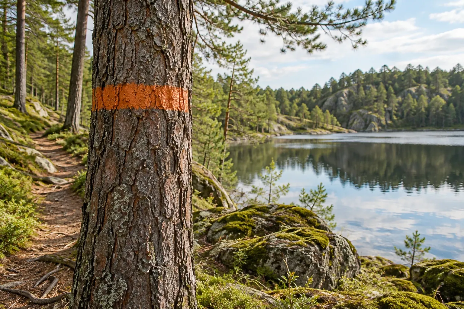
The trail is marked with orange rings around trees and posts, SÖRMLANDSLEDEN signs and S-arrows. Blue on an arrow tip, or a blue dot in a ring, means the section is also a loop. A double ring warns of a sharp turn. Stage boards at each boundary show the stages before and after. On stage 56 the association explicitly warns hikers to follow its orange marks and not other marks in a similar colour.
The detailed 1:40,000 stage maps are for members of the association only. They show shelters, springs and the line of the trail. Membership is cheap (the fee is in Practical information), and the association recommends always walking with a map. The public stage pages are still useful: each has the route in words, a start coordinate, facilities, a list of open fault reports and a button for reporting new ones.
Walking the whole trail
You don’t need to walk it in one go, and most people don’t. The association’s experienced hikers suggest about 15 km a day for a fit walker and around 30 km for an experienced one with light kit. At those rates the main trail takes three to six weeks. If you walk all 62 main stages, the association gives you a diploma at its annual meeting in March. There is no time limit: finishers have taken from 10 days to decades. Since 2024 there is a second diploma for the whole trail, connecting stages and loops included.
Driving instead? The association’s hikers suggest leaving a bike at the stage end, or splitting into two groups that start from opposite ends and swap car keys halfway.
Dogs, ticks and the hunt
| Issue | Rule or risk | Status |
|---|---|---|
| Dogs, 1 March–20 August | Must be kept from running loose where there is wildlife; in practice a lead | Law |
| Dogs in some reserves | Lead all year, e.g. Henaredalen on stage 20 | Law (reserve rules) |
| Ticks and TBE | Every Sörmland municipality on the trail is TBE risk area 1, as are the Stockholm County ones apart from Stockholm and Nacka | Official guidance |
| Moose hunt | 8 October–31 January in Södermanland’s licence areas | Law (county decision) |
The hunt doesn’t close the trail. Allemansrätten lets you walk as long as you don’t disturb a hunt in progress, so watch for hunting signs and wear visible colours. TBE is a real risk on a long walk, so check your vaccination before the trip; see the TBE vaccine guide. The trail is open all year. It’s a lowland route, not a mountain one.
Cycling and riding: the association can’t ban them, but asks people not to ride or cycle on the trail, because its landowner agreements cover walking. Reserve rules may ban them outright.
If you get lost or hurt, call 112. It’s free and works without a SIM card.
Practical information
| Item | Detail |
|---|---|
| Length | About 1,000 km in total; 62 main stages of about 600 km |
| Start | Stage 1 at Björkhagen metro station, Stockholm |
| Marking | Orange rings, SÖRMLANDSLEDEN signs, S-arrows |
| Walking the trail | Free |
| Shelters | About 70, free, can’t be booked |
| Membership incl. detailed maps | 200 kr per year (checked 2026-10-15) |
| Tickets | SL in Stockholm County and to Gnesta; Sörmlandstrafiken in Sörmland (tap a card on board) |
| Fire bans | Per municipality; Krisinformation.se map |
| Emergency | 112 |
FAQ
How long is Sörmlandsleden?
About 1,000 km counting everything, according to the association that runs it. That figure includes 32 connecting stages and the round loops. The main trail is 62 stages, which add up to about 600 km in the association’s stage planner. Stages run from 1.5 to 20 km, and most are between 4 and 15 km.
Can I reach Sörmlandsleden by public transport from Stockholm?
Yes. Stage 1 starts at Björkhagen metro station, 13 minutes from the city. Further out, connecting stages start at Huddinge, Gnesta and Hälleforsnäs stations, and stage 10 ends in Järna, with commuter trains. SL tickets cover Stockholm County and Gnesta; buses in Sörmland need Sörmlandstrafiken tickets, which you can pay for by tapping a bank card on board.
Can I sleep in the shelters on Sörmlandsleden?
Yes. The trail has about 70 shelters, all free, and none can be booked; the rule is to make room until a shelter is full. There are no bins, so carry out your rubbish. Take a tent anyway: not every stage has a shelter, and many nature reserves restrict where you may pitch, so check the reserve rules for each night.
Do I need to pay or join to hike Sörmlandsleden?
No. Walking the trail and using its shelters is free. Membership of Föreningen Sörmlandsleden costs 200 kr a year and gives access to the detailed 1:40,000 stage maps showing shelters and springs. The public stage pages describe the route in words. The association recommends always walking with a map, which makes membership worthwhile for a multi-day trip.
How long does it take to hike all of Sörmlandsleden?
It depends on your pace. The association’s long-distance hikers suggest about 15 km a day for a fit walker and around 30 km for an experienced one with light kit. At those rates the 600 km main trail takes three to six weeks. Most people walk it in sections; finishers have taken anything from 10 days to decades.
Is there drinking water along Sörmlandsleden?
Some. The stage pages name springs and taps, but the association does not guarantee supply or test the water. Most lake water can usually be used if you boil it, and filters or tablets also work. Some taps are seasonal: the one at Stensund on stage 56 is open from 1 May to the end of September. Drink well whenever you pass a spring.
Can I bring my dog on Sörmlandsleden?
Yes, with a lead ready. From 1 March to 20 August Swedish law requires dogs to be kept from running loose where there is wildlife, which in practice means a lead. Some nature reserves on the route require a lead all year, Henaredalen on stage 20 among them. In autumn the moose hunt starts on 8 October.
Related guides
- Day hikes near Stockholm — stages 1–3 as single-day walks, with bus details for each end.
- Tyresta National Park — stage 3 crosses it, and the park’s own camping rules apply.
- Wind shelters in Sweden — how vindskydd work and the etiquette for sharing them.
- Nature reserves and allemansrätten — why reserve rules override the right of access.
- Skåneleden — the southern long-distance trail, if Sörmland leaves you wanting more.
Facts verified 2026-10-15. Sources: Föreningen Sörmlandsleden, Naturvårdsverket, Länsstyrelsen Södermanland, Folkhälsomyndigheten, Krisinformation.se, SL, Sörmlandstrafiken, SOS Alarm and Sveriges riksdag (Lag 2007:1150) — full register in this topic’s source file. Found something outdated? Tell us and we’ll fix it.