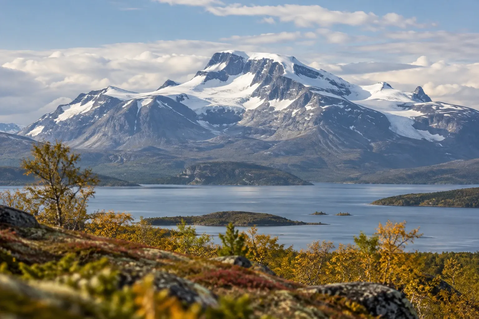
This is the one Laponia national park with a road through it. Here’s what’s left of the famous waterfall, how to get in by car or bus, what you can do in a day, and the park rules that catch visitors out.
When you need this
You’re driving road 827 towards Ritsem and want to know what’s worth stopping for. Or you want a first taste of Laponia, the World Heritage area in Swedish Lapland, without the river crossings of Sarek. Maybe you’re walking Kungsleden from Teusajaure to Saltoluokta, which runs through the park. Or you’re packing and wondering whether the rod, the dog, the bike or the drone can come.
If you’re planning a trackless traverse, our Sarek guide covers that. This page is the gentler neighbour you pass on the way.
What happened to the waterfall
The park was created on 24 May 1909 to protect a waterfall. Five large falls once dropped over the muorkke, a narrow strip of land between two lakes, into the lake Láŋas. People called them “the Niagara of the North”, and the roar could reportedly be heard about ten kilometres away.
In 1919 the Riksdag, Sweden’s parliament, approved a large dam at Suorvvá to power the iron-ore mines and the ore railway. The area to be dammed was taken out of the park and the boundaries redrawn. The dam was raised in four stages between 1923 and 1972. Its reservoir, Áhkkájávrre (Akkajaure), now covers about 260 km², and its water level can vary by more than 30 metres. Old dwelling sites, ancient remains and grazing land lie under it.
Most of the water now runs through tunnels to the power plants. The fall, Stuormuorkkegårttje, still runs, but Naturvårdsverket, the Swedish Environmental Protection Agency, calls it “only a drop” of what it used to be. Come for the mountains, not the old postcards.
What remains is a varied mountain park of old-growth pine forest, birch, heath and glaciers. Above it all stands Áhkká, 2,015 metres high, with 13 peaks and 10 glaciers. The valley Dievssávágge on the northern boundary is often called Sweden’s most beautiful.
Getting there: road 827 and the Road to Ritsem bus
Road 827, Vägen västerut (“the Road to the West”), leaves the E45 just north of Porjus and runs through the park to Ritsem. That’s why Naturvårdsverket calls this the most accessible of Laponia’s four parks.
Without a car, take the train to Gällivare and the seasonal Road to Ritsem bus. You can’t buy its ticket on its own: book it through SJ, Vy or Norrtåg as part of your train ticket. Our guide to getting to the mountains by public transport has the seasons and the booking trick.
| Stop | What it’s for |
|---|---|
| Kebnats | Boat in summer, or ice route and snowmobile in winter, to STF Saltoluokta |
| Stora Sjöfallet / naturum Laponia | Visitor centre, the waterfall, short walks |
| Suorvvá | Cross the dam into the park’s south-west |
| Vakkotavare | STF hut on Kungsleden, trail north |
| Ritsem | Boat across Áhkkájávrre towards Áhkká; helicopters to the Akka huts |
Naturum Laponia and short walks
Naturum Laponia is the visitor centre for the whole World Heritage area. It sits on the headland Viedásnjárgga by the lake Láŋas. Entry is free. It has a café and exhibitions without steps, and you can borrow binoculars.
By car, its car park is on road 827, 92 km after you turn west off the E45. It’s about 300 m on foot to the building. If walking is hard, you can drive to the door. An accessible toilet and a nature trail of boardwalk and packed gravel lead to a barbecue site, which makes this the easiest Laponia stop for wheelchairs and pushchairs.
Short walks from the road:
- The waterfall: the path from the road is mostly boardwalk, but the last stretch is stony. The path on the lake’s south side is stony all the way and not one for inexperienced hikers.
- Soldalen and Ippátjåhkkå: a signposted path climbs from the road through one of Europe’s oldest pine forests to open heath, with views over Láŋas. Carry on for the summit.
- Giergav: from Saltoluokta, its summits look towards Sarek and the Kebnekaise massif.
The chance of seeing moose is high. Lynx, wolverine and bear live here too, and golden eagles and peregrine falcons breed in the park.
Kungsleden through the park
The Kungsleden stage between Teusajaure and Vakkotavare runs through the park. STF Teusajaure lies about 16 km north of STF Vakkotavare, and in summer you cross the lake Teusajaure by boat. Vakkotavare stands by the road on Akkajaure’s north shore, with its own bus stop and a large car park.
From Vakkotavare, the trail continues by road. Hikers take the bus to Kebnats and the boat to Saltoluokta. STF notes that the steep climb from Vakkotavare up to the open fell pays off with a view over Akkajaure, Sarek and Áhkká, so it also works as a day walk. See the Kungsleden guide for the whole trail and STF mountain huts for how the huts work.
Park rules: what’s allowed
The park rules are Naturvårdsverket’s regulations for the four Laponia parks, NFS 2013:10. They’re law, and stricter than allemansrätten, Sweden’s right of public access, in the mountains around them.
| Activity | Rule |
|---|---|
| Tenting | Allowed anywhere for a couple of nights in the same place |
| Campfire | Allowed, with loose sticks from the ground only; no breaking, cutting or sawing trees or shrubs |
| Fishing and hunting | Banned in the park |
| Dogs | Leashed anywhere 1 January–30 April; otherwise only on Kungsleden and in a set area |
| Cycling and riding | Only on public roads and the private roads to Ritsem and to Sádijávrre |
| Motor boats | Only on the route Kebnats–Saltoluokta–the Sjöfallet power plant |
| Snowmobiles | Only on public snowmobile trails over well snow-covered ground |
| Cars, caravans, trailers | Only on designated places |
| Drones | Not below 2,000 ft without the county board’s permit |
| Berries and mushrooms | Edible ones may be picked |
Aircraft landings, dog sleds and organised recurring tours or camps need a permit from Länsstyrelsen Norrbotten, the county administrative board. Never deliberately disturb grazing reindeer or a herd being gathered. If a herd draws away, you’re too close; sit and wait, or walk round.
The land is grazing ground for the Sámi reindeer-herding communities Sirges and Unna tjerusj. Their herding rights apply across the whole park, which is why you may see herders using vehicles or helicopters that visitors can’t.
Fishing and dogs: the two rules that catch people
Fishing. Two STF hut pages advertise good fishing in Akkajaure, but the park regulations ban fishing inside the park. The reservoir area was taken out of the park in 1919, yet the park lies on both sides of it, and we couldn’t confirm from official sources exactly where the boundary runs on the water. Before casting anywhere near the park, check the maps in the county’s fishing-permit appendices. Länsstyrelsen Norrbotten sells permits for state mountain waters and allows trolling in Stora Lulevatten. See fishing rules in Sweden for how permits work.
Dogs. From 1 May to 31 December a leashed dog is allowed only on Kungsleden and inside an area bounded by the Stora Lulevatten lakes to the south and the power line to the north. Laponiatjuottjudus, which manages the park, shows the area on a map. One STF page says “no dogs in the park in summer”, which oversimplifies the rule. Our dogs in nature guide compares all the mountain parks.
Seasons
| Period | What to expect |
|---|---|
| March–April | Sun returns; leashed dogs allowed anywhere until 30 April; naturum opened 1 April in 2026 |
| May | Reindeer calving: do not disturb; ice weakens, streams rise |
| June | Spring floods, first calf markings; naturum open daily from 17 June in 2026 |
| July | Mosquitoes, calf marking and peak hiking season |
| August | Often the best hiking month as mosquitoes fade |
| September | Autumn colours; boats and naturum close for the season |
| October–March | Snow, then deep winter; no naturum, no summer services |
Laponiatjuottjudus names mid-July to September as the best hiking window in western Laponia. If you come in October, you’ll find the park, but not the facilities.
Safety and the 2026 road notice
Read the road notice before you drive. Part of the road from Stora Sjöfallet to Ritsem was hit by a landslide. On 18 June 2026 Laponiatjuottjudus reported it passable again, but the slide stretch has no guardrails, is marked with posts, has a 30 km/h limit, and you may stop or park only at designated places. All travel on the road is at your own risk.
Mobile coverage is patchy. There’s generally GSM coverage on Telia’s network at Vakkotavare and none at Teusajaure. Weather changes fast. Leave a travel plan with your route and return time with someone at home, because hut guestbooks aren’t followed up unless someone is reported missing. In an emergency call 112; the police run mountain rescue. Our mountain safety guide covers the rest.
Water is generally clear and clean, and you can often drink from running streams. Along road 827 inside the park there are car parks with dry toilets at Vuoksájávrre, Rájvogielas and Ritsem.
Practical information
| Item | Detail (checked 2026-10-15) |
|---|---|
| Park entry | No entry fee mentioned by the park or Laponia pages |
| Naturum Laponia | Free entry; 2026 season 1 April–27 September (daily 17 June–30 August, otherwise Wednesday–Sunday) |
| Tenting | Free under allemansrätten; a couple of nights per spot |
| Bus | Road to Ritsem from Gällivare, booked with the train via SJ, Vy or Norrtåg |
| Driving | Naturum car park 92 km west of the E45 turn; Kebnats 78 km |
| Dievssájávri rowing boats | Removed 14 September in 2026 |
| Huts | STF Vakkotavare and Teusajaure, 2027 seasons 26 February–18 April and 24 June–19 September |
| Prices | Not published here: huts, buses and boats vary by season and operator |
FAQ
Is there still a waterfall at Stora Sjöfallet?
Yes, but a small one. Stuormuorkkegårttje was once five great falls, called the Niagara of the North, and its roar reportedly carried about ten kilometres. Since the Suorvvá dam was built from 1919 onwards, most of the water runs through tunnels to the power plants. A mostly boardwalked path leads from the road, with a rocky final stretch.
How do I get to Stora Sjöfallet National Park?
Take road 827, the Road to the West, which leaves the E45 north of Porjus and crosses the park on its way to Ritsem. Without a car, take the train to Gällivare and the seasonal Road to Ritsem bus, booked through SJ, Vy or Norrtåg with your train ticket. It stops at Kebnats, naturum Laponia, Suorvvá, Vakkotavare and Ritsem.
Can I fish in Stora Sjöfallet National Park?
Not inside the park. Naturvårdsverket’s regulations for the four Laponia parks ban fishing and hunting, and the only fishing exception covers set waters in Padjelanta. Waters outside the boundary are a different matter: the county sells permits for state waters in the mountains. Check the county’s fishing-permit maps before casting near the park edge.
Can I bring my dog to Stora Sjöfallet?
Partly. From 1 January to 30 April a leashed dog may go anywhere in the park. The rest of the year a leashed dog is allowed only on Kungsleden and in a set area between the Stora Lulevatten lakes and the power line. Dog sleds need a permit from Länsstyrelsen Norrbotten.
Can I camp in Stora Sjöfallet National Park?
Yes. Allemansrätten applies, so you may pitch a tent for a couple of nights in the same place anywhere in the park. Fires are allowed with loose sticks from the ground, but not by breaking or cutting trees or shrubs. A camper or caravan may only stand at designated places, not in the terrain or at the roadside.
When is naturum Laponia open?
Seasonally. In 2026 naturum Laponia opened on 1 April, ran Wednesday to Sunday until mid-June, opened daily from 17 June to 30 August, and then Wednesday to Sunday until it closed on 27 September. Entry is free and the building is accessible. Check the 2027 hours on Laponiatjuottjudus’s naturum page before an early-spring or autumn visit.
Is Stora Sjöfallet a good park for families or visitors with limited mobility?
It is the easiest of the Laponia parks. Road 827 crosses it, naturum has step-free exhibitions, an accessible toilet and a boardwalk-and-gravel nature trail to a barbecue site, and you can drive to the building door if walking is hard. The waterfall path is mostly boardwalk but ends on stony ground.
Related guides
- Sarek National Park — the trackless neighbour you can enter from Suorvvá or Ritsem.
- Kungsleden — the full trail, including the stage through this park.
- Getting to the mountains by public transport — how to book Road to Ritsem with your train.
- Swedish Lapland — the wider region and the Laponia World Heritage area.
- Sámi culture — whose land this park is.
Facts verified 2026-10-15. Sources: Naturvårdsverket (NFS 2013:10 and Sveriges nationalparker), Laponiatjuottjudus, Länsstyrelsen Norrbotten, SMHI, Jokkmokk municipality, Svenska Turistföreningen (STF), Road to Ritsem, Polisen, Fjällsäkerhetsrådet — full register in this topic’s source file. Found something outdated? Tell us and we’ll fix it.